Garmin Edge 305$175.00 to $449.00

Rugged, lightweight Edge attaches easily to the stem or handlebars of your bike with the included bike mount. Just turn it on, acquire GPS satellites and go. Edge 305 automatically measures your speed, distance, time, calories burned, altitude, climb and descent, and also records the route you have taken for review. For extra-precise climb and descent data, Edge 305 also incorporates a barometric altimeter to pinpoint changes in elevation.Minimize
Manufacturer:Garmin Product MPN MPN | GE305CAD | Key Features GPS Type | Handheld (Outdoor) | Form Factor | Handheld | Screen Size | 1.9 in. | Display Display Size | 1.17 in. x 1.44 in. | Display Type | 4 Level Grayscale LCD Display | Resolutions | 128 x 160 | Technical Features Special Features | Built-In Barometer, Built-In Altimeter, Heart Rate Monitor, Training Computer | Trip calculator | Maximum speed, Elevation Computer | Other Features PC Interface | USB | Environmental Protection | IPX7 Waterproof Standard | Antenna | Built-in | Battery Battery Type and Quantity | Proprietary Lithium | Battery Life | 12 Hours | Warranty Warranty | 1 Year | Dimensions Width | 1.75 in. | Depth | 0.9 in. | Height | 3.7 in. | Weight | 0.19 lb. | Miscellaneous UPC | 753759051716 |
Tags:garmin, edge, 305,
| Garmin Forerunner 101$89.00 to $114.00
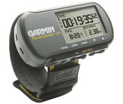
The Forerunner 101 offers athletes and recreational walkers and runners an entry-level personal training device with GPS. It has the same features as the Forerunner 201, but operates on two AAA batteries. The Forerunner 101 stores lap histories for up to two years to provide an archive of workout performance over time. Users can retrieve lap data for previous workouts by date, week, month, or over a specific time interval. For business travelers who want to train on the road, the Forerunner 101 also doubles as a navigator. Users can mark their hotel as a specific location, see their current position on the plotter display, and follow an electronic breadcrumb trail back to their starting point.Minimize
Manufacturer:Garmin Product MPN MPN | 010-00329-00 | Key Features GPS Type | Handheld (Outdoor) | Form Factor | Handheld | Receiver Type | 12 Channels | Screen Size | 1.7 in. | Display Display Size | 1.5 in. x 0.9 in. | Display Type | LCD Display | Resolutions | 100 X 64 | Technical Features Special Features | Built-In Altimeter | Audible Features | Arrival Alarm | Trip calculator | Maximum speed | Other Features Environmental Protection | IPX7 Waterproof Standard | Antenna | Built-in | GPS System Accuisition Time - Cold | 45 sec | Accuisition Time - Initial Time | 15 sec | Waypoints | 100 | Battery Battery Type and Quantity | 2 x AAA Batteries | Battery Life | 15 Hours | Warranty Warranty | 1 Year | Dimensions Width | 3.3 in. | Depth | 0.9 in. | Height | 1.7 in. | Weight | 0.16 lb. | Miscellaneous Family Line | Garmin Forerunner | UPC | 0753759044114 |
Tags:garmin, forerunner, 101,
| Navman NavPix N40i$80.00 to $230.00
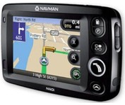
The N40i includes an integrated digital camera for taking NavPix to create an unmistakeable reminder of your chosen destination. So you can find your way there - no matter how far away it is – whenever you want.
Manufacturer:Navman Product MPN MPN | N40i | Key Features GPS Type | Automobile | Input Method | Touch Screen | Display Display Size | 3.5 in. | Display Type | LCD Display | Technical Features Audible Features | Voice Navigation Instructions | Included Software/Maps | USA Maps, Europe Maps, Australia Maps, Ireland | Other Features PC Interface | USB 1.1 | Built in memory | 64 MB | GPS System Update rate | 1 per second, continuous | Battery Battery Type and Quantity | Rechargeable Li-Ion Battery | Battery Life | 5 Hours | Dimensions Width | 4.65 in. | Depth | 0.89 in. | Height | 3.19 in. | Weight | 0.44 lb. | Miscellaneous UPC | 817186001376 |
Tags:navman, navpix, n40i,
|
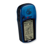
With the eTrex Legend, GARMIN has loaded a full basemap of North and South America into one small unit. The Legend is also designed to provide precise GPS positioning using correction data obtained from the Wide Area Augmentation System (WAAS). This product will provide position accuracy to less than three meters when receiving WAAS corrections.Minimize

The new GP37 DGPS/WAAS Navigator is compact in size, yet big on power, features and performance. This waterproof unit is perfect for a wide range of boats. It is equipped with a WAAS and a DGPS receiver as standard supply. It utilizes both WAAS and differential radio beacon correction methods to give you the most accurate position fix available. The GP37 offers extremely accurate position fixes -- 10m for basic GPS, 5m or better with DGPS and 3m or better where WAAS service is available. It should be noted that DGPS is more reliable and accurate, as the WAAS system is still currently under development. There is no guarantee of accuracy, integrity, continuity or availability of the WAAS signal. For that reason, the GP37 runs with DGPS as the default setting in auto selection mode. In this mode, if the DGPS signal can not be received for any reason, the WAAS mode is automatically selected. Manual setting is also available. The display modes include Plotter, two Customizable displays, Steering, Highway and SpeedMinimize
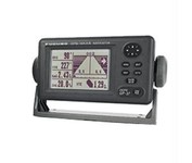
Compact in size, waterproof, yet big on power, features and performance, Furunos GP32 is perfect for a wide range of smaller fishing boats and pleasure craft. This advanced unit, based on the popular GP31, provides accurate and reliable position fixing, thanks to a super sensitive, 12-channel GPS receiver combined with integrated WAAS technology. The unit has a waterproof display and is built to stand up to tough marine conditions. This durable casing houses an impressive memory, capable of storing up to 1,000 points of ships track, 999 points for marks and waypoints, and 50 routes of up to 30 waypoints each. Vital navigation data is presented on a 4.5-inch diagonal Silver Bright LCD screen with adjustable brilliance. Innovative graphic displays include Nav, Highway, Steering, Track Plotting, and two operator programmable modes, all extremely easy to use. The GP32, like all Furuno nav receivers, feature Furunos NMEA 0183 programmable interface system for feeding highly accurate nav data to your Furuno radar, Minimize
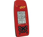
Just grab this bright yellow handheld iFINDER Go 64MB GPS and go, go, go. It's easy to use, waterproof, has a 2.2 diagonal Film SuperTwist display with backlighting and a built-in 64MB background map with coverage of the continental U.S. and Hawaii. The GPS also includes up to 1,000 waypoints, 1,000 event markers and 100 routes; up to 100 retraceable plot trails and up to 10,000 points in any trail; 30+ map zoom ranges and 42 graphic icons to mark spots.Minimize