GlobalSat BT-359$40.00 to $90.00
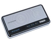
The GlobalSat BT-359 Bluetooth GPS receiver is our solution of the line Bluetooth GPS, which have both stylish and functional in true GlobalSat tradition. Taking its design criteria from the market leading BT-338 we have pushed the limits of GPS even further with greater sensitivity, more accuracy, and longer battery life than ever beforeMinimize
Manufacturer:GlobalSat Product MPN MPN | BT-359 | Key Features GPS Type | Handheld (Outdoor) | Form Factor | Wireless Receiver Module | Enhanced accuracy | WAAS enabled, EGNOS enabled | Receiver Type | 20 Channels | Other Features PC Interface | NMEA-0183, Bluetooth | Antenna | Built-in | GPS System Accuisition Time - Cold | 42 sec | Accuisition Time - Initial Time | 38 sec | Accuisition Time - Hot | 1 sec | Max. Horizontal accuracy | Battery | Battery Type and Quantity | Proprietary Lithium | Battery Life | 11 Hours | Dimensions Width | 3.23 in. | Depth | 0.53 in. | Height | 1.61 in. | Miscellaneous UPC | 4043619603046 |
Tags:globalsat, bt-359,
| Garmin nuvi 200W$150.00 to $350.00
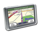
Wide and way cool, nüvi 200W shows you the way with detailed maps on a bright widescreen display and clear, voice-prompted directions. This stylish navigator and travel companion comes with preloaded maps for the lower 48 states, Hawaii and Puerto Rico or regional coverage in other areas. Like the rest of the nüvi 200-series, nüvi 200W is affordably priced and simple to use.Minimize
Manufacturer:Garmin Product MPN MPN | 010-N0656-1 | Key Features GPS Type | Automobile | Form Factor | Fixed | Map capabilities | Internal, Map cartridges / Data cards | Enhanced accuracy | WAAS enabled, EGNOS enabled | Input Method | Touch Screen | Receiver Type | 12 Channels | Screen Size | 4.4 in. | Display Display Size | 3.81 in. x 2.25 in. | Display Type | 65k Colors Display | Resolutions | 480 x 272 | Technical Features Special Features | Waypoint Icons, JPEG Image Viewer, Converter, Calculator, 3D Map View | Audible Features | Voice Navigation Instructions | Trip calculator | Shortest time, Shortest distance, Maximum speed, Odometer, Current speed, Route Recalculation, Trip Timers, Avoid toll roads, Detour Feature, Points-of-Interest (POI) | Included Software/Maps | Europe Maps, Germany Maps | Other Features PC Interface | USB | Expansion Slot Type | SD (Secure Digital) Card Slot | Antenna | Built-in | GPS System Waypoints | 500 | Battery Battery Type and Quantity | Rechargeable Li-Ion Battery | Battery Life | 5 Hours | Dimensions Width | 4.8 in. | Depth | 0.8 in. | Height | 2.9 in. | Weight | 0.38 lb. | Miscellaneous Family Line | Garmin nuvi | UPC | 753759074524 |
Tags:garmin, nuvi, 200w,
| Garmin Forerunner 205$128.00 to $413.00
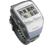
The Forerunner 205 sports a unique design that wraps the GPS antenna around part of the wrist for a better view of the sky, and its high sensitivity GPS receiver can track under trees and near tall buildings.
Manufacturer:Garmin Product MPN MPN | 010-00466-00 | Key Features GPS Type | Handheld (Outdoor) | Form Factor | Handheld | Input Method | Keypad | Screen Size | 1.5 in. | Display Display Size | 1.3 in. x 0.8 in. | Display Type | LCD Display | Resolutions | 160 X 100 | Technical Features Special Features | Training Computer, 3D Map View | Trip calculator | Maximum speed, Current speed, Trip Timers, Elevation Computer, Time of sunrise/sunset | Other Features PC Interface | USB | Environmental Protection | IPX7 Waterproof Standard | Antenna | Built-in | GPS System Accuisition Time - Cold | 45 sec | Accuisition Time - Initial Time | 38 sec | Accuisition Time - Hot | 1 sec | Update rate | 1 per second, continuous | Max. Horizontal accuracy | | Number of routes | 50 | Waypoints | 100 | Battery Battery Type and Quantity | Proprietary Lithium | Battery Life | 10 Hours | Warranty Warranty | 1 Year | Dimensions Width | 2.1 in. | Depth | 2.7 in. | Height | 0.7 in. | Weight | 0.17 lb. | Miscellaneous Family Line | Garmin Forerunner | UPC | 753759051914 |
Tags:garmin, forerunner, 205,
|
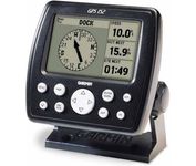
The GPS 152 is a 12 parallel channel GPS receiver loaded with a database of American cities and nautical navigation aids such as lights, buoys, sound signals, day beacons and tide data. Built-in memory of one megabyte makes the GPS 152 compatible with GARMIN's MapSource Points of Interest CD. With this CD and the GPS 152, you add additional marine navaid detail to your unit.In addition to larger memory, the GPS 152 is compatible with the Wide Area Augmentation System (WAAS), a technology designed to improve the accuracy of GPS positioning to about three meters.On the outside, the GPS 152 comes housed in a waterproof case that's about four inches high and five inches wide. A large four-inch diagonal, high-contrast display features 100x160 pixels for the ultimate in readability. A simple keypad at the bottom of the unit makes entering information easy, without blocking your view of the display.Minimize

The eTrex Summit comes on the heels of the extremely popular eTrex, which was designed for both marine and recreation use. This new all-in-one navigation device for the outdoor enthusiast is the first combination GPS, altimeter, and electronic compass. The electronic compass provides bearing information when you're standing still and the altimeter determines precise altitude, so you can tell how high you've climbed and your rate of ascent. Like its predecessor, the eTrex Summit boasts a powerful 12 parallel channel GPS receiver and comes packaged in a small, sleek case with operating buttons located on either side of the unit. The case is completely waterproof to withstand immersion in one meter of water for up to 30 minutes.Minimize
The handheld mapping GPS designed by hunters for hunters lets you follow the big game in color with 16-channel GPS precision. The iFINDER® Hunt C with color display offers everything you'd expect in a versatile, precision mapping GPS unit made for the field, including hunting-specific icons, unique "Scout Mode", electronic compass, barometric altimeter, built-in microphone, and more.Minimize
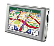
The Garmin nuvi 650 isn’t just a portable GPS system; it’s a fully featured multimedia device capable of MP3 playback and JPEG picture viewing. The nuvi 650 comes preloaded with City Navigator NT street maps that are loaded with hundreds of useful points of interest including gas stations, restaurants, and movie theaters. The touch screen interface gives you quick and easy access the nuvi 650’s many functions, and with the slim, sleek design you can easily stow it in your purse, backpack, or pocket. A rechargeable lithium-ion battery makes it suitable for navigation while in the car or even on foot.Minimize