GlobalSat BT-359$40.00 to $90.00
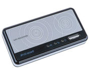
The GlobalSat BT-359 Bluetooth GPS receiver is our solution of the line Bluetooth GPS, which have both stylish and functional in true GlobalSat tradition. Taking its design criteria from the market leading BT-338 we have pushed the limits of GPS even further with greater sensitivity, more accuracy, and longer battery life than ever beforeMinimize
Manufacturer:GlobalSat Product MPN MPN | BT-359 | Key Features GPS Type | Handheld (Outdoor) | Form Factor | Wireless Receiver Module | Enhanced accuracy | WAAS enabled, EGNOS enabled | Receiver Type | 20 Channels | Other Features PC Interface | NMEA-0183, Bluetooth | Antenna | Built-in | GPS System Accuisition Time - Cold | 42 sec | Accuisition Time - Initial Time | 38 sec | Accuisition Time - Hot | 1 sec | Max. Horizontal accuracy | Battery | Battery Type and Quantity | Proprietary Lithium | Battery Life | 11 Hours | Dimensions Width | 3.23 in. | Depth | 0.53 in. | Height | 1.61 in. | Miscellaneous UPC | 4043619603046 |
Tags:globalsat, bt-359,
| Garmin GPSMAP 440s$437.00 to $1,032.00

Offshore fishermen and boaters will gravitate toward this sleek, space-saving chartplotter. The GPSMAP 440 features preloaded detailed maps for the U.S. coast as well as an ultra-bright 4” QVGA display; built-in, satellite-enhanced worldwide basemap and simplified user operation.
Manufacturer:Garmin Product MPN MPN | 010-00516-44 | Key Features GPS Type | Marine | Form Factor | Fixed | Map capabilities | Internal, Map cartridges / Data cards | Enhanced accuracy | WAAS enabled, EGNOS enabled | Input Method | Keypad | Receiver Type | 12 Channels | Screen Size | 4 in. | Display Display Size | 2.4 in. x 3.2 in. | Display Type | LCD Display | Resolutions | 240 X 320 | Technical Features Marine Features | Tide Prediction, Split Screen, Water Temp. Sensor, Depth Display, Chart Plotter, Sonar / Sounder, MOB (Man Over Board) | Audible Features | Anchor Alarm, Arrival Alarm, Clock Alarm, Accuracy Alarm, Fish Alarm, Shallow/Deep Alarm, Low Battary/Voltage Alarm, Water Temperature Alarm | Trip calculator | Route Recalculation, Trip Timers, Points-of-Interest (POI) | Included Software/Maps | Marine Cartography | Other Features PC Interface | NMEA-0183 | Environmental Protection | IPX7 Waterproof Standard | Expansion Slot Type | SD (Secure Digital) Card Slot | Antenna | Built-in, External Antenna Hookup | GPS System Accuisition Time - Cold | 45 sec | Accuisition Time - Initial Time | 15 sec | Update rate | 1 per second, continuous | Waypoints | 1500 | Warranty Warranty | 1 Year | Dimensions Width | 5.7 in. | Depth | 2.7 in. | Height | 5 in. | Weight | 1.3 lb. | Miscellaneous Family Line | Garmin GPSMAP | UPC | 753759065836 |
Tags:garmin, gpsmap, 440s,
| Garmin StreetPilot i5$181.00 to $450.00

It may be tiny, but the StreetPilot i5 is packed with state-of-the-art navigation features. The StreetPilot i5 comes preloaded with incredibly detailed City Navigator NT street maps that are packed with nearly 6 million points of interest including hotels, restaurants, ATMs and much more. A simple rolling-wheel interface allows you to quickly adjust settings and alter routes to your destination. Built for portability and power, the StreetPilot i5 is a cost effective portable GPS solution. Minimize
Manufacturer:Garmin Product MPN MPN | SPI5 | Key Features GPS Type | Automobile | Form Factor | Handheld | Enhanced accuracy | WAAS enabled | Receiver Type | 12 Channels | Screen Size | 2.1 in. | Display Display Size | 1.7 in. x 1.3 in. | Display Type | 32k Colors LCD TFT Display | Resolutions | 220 x 176 | Technical Features Audible Features | Voice Navigation Instructions | Trip calculator | Detour Feature, Points-of-Interest (POI) | Other Features PC Interface | USB | Battery Battery Type and Quantity | 2 x AA Batteries | Battery Life | 7 Hours | Dimensions Width | 3 in. | Depth | 2.15 in. | Height | 2.74 in. | Weight | 0.32 lb. | Miscellaneous Family Line | Garmin StreetPilot | UPC | 840356505404 |
Tags:garmin, streetpilot, i5,
|

The new GP37 DGPS/WAAS Navigator is compact in size, yet big on power, features and performance. This waterproof unit is perfect for a wide range of boats. It is equipped with a WAAS and a DGPS receiver as standard supply. It utilizes both WAAS and differential radio beacon correction methods to give you the most accurate position fix available. The GP37 offers extremely accurate position fixes -- 10m for basic GPS, 5m or better with DGPS and 3m or better where WAAS service is available. It should be noted that DGPS is more reliable and accurate, as the WAAS system is still currently under development. There is no guarantee of accuracy, integrity, continuity or availability of the WAAS signal. For that reason, the GP37 runs with DGPS as the default setting in auto selection mode. In this mode, if the DGPS signal can not be received for any reason, the WAAS mode is automatically selected. Manual setting is also available. The display modes include Plotter, two Customizable displays, Steering, Highway and SpeedMinimize
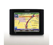
The Nextar GPS X3B mobile navigation system assures that your days of getting lost are over! Finding an address or any of 1.6 million points of interest such as the nearest gas station or restaurant is a snap anywhere in the U.S. or Canada. Just enter information in the X3B's 3.5 inch touch screen and let the voice prompt and detailed map guide you to the destination. With the latest TTS (Text to Speech) function, street names are clrearly pronounced in English. The X3B's built in MP3 player will entertain you with your favorite tunes while en route. Just copy your favorite play list onto an SD card and insert into the slot. The X3B moves easily from car to car using the convenient vent mount. A recharageable lithium ion battery assures that the unit stays active. Other features of the X3B include built-in maps of the 50 United States and Canada, 1GB built in Flash Memory.Minimize
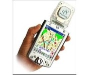
Pharos, the leader in advanced, affordable navigation solutions for handheld computing, has created the ultimate navigation tool for Windows Mobile-based Pocket PCs and mobile devices. Use Pharos Pocket GPS Navigator with CompactFlash to navigate door-to-door or point-to-point. Use it for hiking, walking tours or other outdoor activities. With audio voice prompts to guide you to your destination, the Pocket GPS Navigator is great for your car, too. In fact, the Pharos GPS Navigator performs just like more expensive, factory-installed, in-vehicle navigation systems, at a fraction of the cost yet, its easy to load into your Pocket PC and simple to use.Minimize
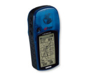
With the eTrex Legend, GARMIN has loaded a full basemap of North and South America into one small unit. The Legend is also designed to provide precise GPS positioning using correction data obtained from the Wide Area Augmentation System (WAAS). This product will provide position accuracy to less than three meters when receiving WAAS corrections.Minimize