GlobalSat BT-359$40.00 to $90.00
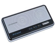
The GlobalSat BT-359 Bluetooth GPS receiver is our solution of the line Bluetooth GPS, which have both stylish and functional in true GlobalSat tradition. Taking its design criteria from the market leading BT-338 we have pushed the limits of GPS even further with greater sensitivity, more accuracy, and longer battery life than ever beforeMinimize
Manufacturer:GlobalSat Product MPN MPN | BT-359 | Key Features GPS Type | Handheld (Outdoor) | Form Factor | Wireless Receiver Module | Enhanced accuracy | WAAS enabled, EGNOS enabled | Receiver Type | 20 Channels | Other Features PC Interface | NMEA-0183, Bluetooth | Antenna | Built-in | GPS System Accuisition Time - Cold | 42 sec | Accuisition Time - Initial Time | 38 sec | Accuisition Time - Hot | 1 sec | Max. Horizontal accuracy | Battery | Battery Type and Quantity | Proprietary Lithium | Battery Life | 11 Hours | Dimensions Width | 3.23 in. | Depth | 0.53 in. | Height | 1.61 in. | Miscellaneous UPC | 4043619603046 |
Tags:globalsat, bt-359,
| Garmin GPSMAP 440s$437.00 to $1,032.00

Offshore fishermen and boaters will gravitate toward this sleek, space-saving chartplotter. The GPSMAP 440 features preloaded detailed maps for the U.S. coast as well as an ultra-bright 4” QVGA display; built-in, satellite-enhanced worldwide basemap and simplified user operation.
Manufacturer:Garmin Product MPN MPN | 010-00516-44 | Key Features GPS Type | Marine | Form Factor | Fixed | Map capabilities | Internal, Map cartridges / Data cards | Enhanced accuracy | WAAS enabled, EGNOS enabled | Input Method | Keypad | Receiver Type | 12 Channels | Screen Size | 4 in. | Display Display Size | 2.4 in. x 3.2 in. | Display Type | LCD Display | Resolutions | 240 X 320 | Technical Features Marine Features | Tide Prediction, Split Screen, Water Temp. Sensor, Depth Display, Chart Plotter, Sonar / Sounder, MOB (Man Over Board) | Audible Features | Anchor Alarm, Arrival Alarm, Clock Alarm, Accuracy Alarm, Fish Alarm, Shallow/Deep Alarm, Low Battary/Voltage Alarm, Water Temperature Alarm | Trip calculator | Route Recalculation, Trip Timers, Points-of-Interest (POI) | Included Software/Maps | Marine Cartography | Other Features PC Interface | NMEA-0183 | Environmental Protection | IPX7 Waterproof Standard | Expansion Slot Type | SD (Secure Digital) Card Slot | Antenna | Built-in, External Antenna Hookup | GPS System Accuisition Time - Cold | 45 sec | Accuisition Time - Initial Time | 15 sec | Update rate | 1 per second, continuous | Waypoints | 1500 | Warranty Warranty | 1 Year | Dimensions Width | 5.7 in. | Depth | 2.7 in. | Height | 5 in. | Weight | 1.3 lb. | Miscellaneous Family Line | Garmin GPSMAP | UPC | 753759065836 |
Tags:garmin, gpsmap, 440s,
| Acr Electronics TerraFix 406$234.00 to $487.00
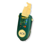
Accidents happen every day in the outdoors, whether you fall out of a tree stand, break a leg during a hike, or roll over on an ATV. In the outdoors, an every day accident instantly can become a life threatening situation, and rescues may take days or weeks if you’re not prepared.
Manufacturer:Acr Electronics Product MPN MPN | 210218942 | Key Features GPS Type | Automobile | Form Factor | Wireless Receiver Module | Dimensions Weight | 0.83 lb. | Miscellaneous UPC | 791659001806 |
Tags:acr, electronics, terrafix, 406,
|
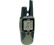
The Rino 120 is state-of-the-art GPS navigation and two-way communications combined, with enough memory to download detailed mapping for driving, hiking, hunting, fishing--or just about anything else you can dream up.
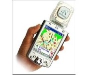
Pharos, the leader in advanced, affordable navigation solutions for handheld computing, has created the ultimate navigation tool for Windows Mobile-based Pocket PCs and mobile devices. Use Pharos Pocket GPS Navigator with CompactFlash to navigate door-to-door or point-to-point. Use it for hiking, walking tours or other outdoor activities. With audio voice prompts to guide you to your destination, the Pocket GPS Navigator is great for your car, too. In fact, the Pharos GPS Navigator performs just like more expensive, factory-installed, in-vehicle navigation systems, at a fraction of the cost yet, its easy to load into your Pocket PC and simple to use.Minimize
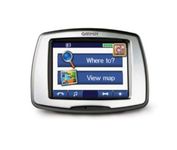
From Garmin, the leader in portable GPS solutions, the StreetPilot c550 is easy to use, and rich with features. The StreetPilot c550 comes preloaded with City Navigator NT street maps and includes a large database of points of interest including motels, restaurants, gas stations, and grocery stores. The simple touch screen interface gives you excellent control over menus and settings, and with Bluetooth support, you can even use the c550 for hands-free calling using the built-in speaker and microphone.Minimize

The GP-7000F/NT is a GPS/WAAS plotter designed for a variety of vessels desiring video plotting and echo sounding capabilities. With the GP-7000 series, you can see the highly accurate position of your boat on the chart. The GP-7000 series has four display modes: Course Plot, Nav Data, Steering, and Highway modes. The course plot mode is useful for obtaining general information about surrounding sea areas. The Nav data mode clearly shows important navigational information with large text, which is easy to see even from a distance. The steering mode and highway mode assist the operator in following a predetermined route.Minimize