Garmin eTrex Legend$110.00 to $270.00
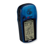
With the eTrex Legend, GARMIN has loaded a full basemap of North and South America into one small unit. The Legend is also designed to provide precise GPS positioning using correction data obtained from the Wide Area Augmentation System (WAAS). This product will provide position accuracy to less than three meters when receiving WAAS corrections.Minimize
Manufacturer:Garmin Product MPN MPN | ETREX LEGEND | Key Features GPS Type | Handheld (Outdoor) | Form Factor | Handheld | Map capabilities | Internal, Download maps | Enhanced accuracy | WAAS enabled | Input Method | Thumb Stick | Receiver Type | 12 Channels | Screen Size | 2.4 in. | Display Display Size | 1.1 in. x 2.1 in. | Display Type | LCD Display | Technical Features Special Features | Waypoint Icons | Trip calculator | Maximum speed, Current speed, Trip Timers, Time of sunrise/sunset, Track Log, Points-of-Interest (POI) | Included Software/Maps | Marine Cartography, City Navigation Maps, North America Maps, Europe Maps, Australia Maps, South Africa Maps, South America Maps, Middle East Maps, Asia Maps | Grids | Lat/Lon, MGRS, UTM, Loran TD position format, Maidenhead | Other Features PC Interface | Serial RS-232, NMEA-0183 | Built in memory | 8 MB | Environmental Protection | IPX7 Waterproof Standard | Antenna | Built-in | GPS System Accuisition Time - Cold | 45 sec | Accuisition Time - Initial Time | 15 sec | Update rate | 1 per second, continuous | Max. Horizontal accuracy | | Enhanced position accuracy | | Differential standards | DGPS Ready | Number of routes | 20 | Waypoints | 1000 | Battery Battery Type and Quantity | 2 x AA Batteries | Battery Life | 18 Hours | Warranty Warranty | 1 Year | Dimensions Width | 2 in. | Depth | 1.2 in. | Height | 4.4 in. | Weight | 0.33 lb. | Miscellaneous Family Line | Garmin eTrex | UPC | 753759030186 |
Tags:garmin, etrex, legend,
| Garmin StreetPilot c580$270.00 to $940.00
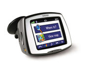
Receive door-to-door directions while staying on top of weather, traffic and localized information with the StreetPilot c580. Similar to the c550, StreetPilot c580 comes with hands-free calling, preloaded maps and an MP3 player, then takes it up a notch by adding dynamic content from MSN® Direct.
Manufacturer:Garmin Product MPN MPN | 010-00522-06 | Key Features GPS Type | Automobile | Form Factor | Fixed | Map capabilities | Internal, Download maps | Enhanced accuracy | WAAS enabled, EGNOS enabled | Input Method | Touch Screen | Receiver Type | 18 Channels | Screen Size | 3.5 in. | Display Display Size | 2.8 in. x 2.1 in. | Display Type | 16-bit Color LCD TFT Display | Resolutions | 320 X 240 | Technical Features Special Features | MP3 Player, JPEG Image Viewer, 3D Map View | Trip calculator | Shortest time, Maximum speed, Current speed, Route Recalculation, Points-of-Interest (POI) | Included Software/Maps | North America Maps, Canada Maps, Europe Maps, Australia Maps, South Africa Maps, South America Maps, Middle East Maps, Great Britain | Other Features PC Interface | USB | Expansion Slot Type | SD (Secure Digital) Card Slot | Antenna | Built-in, External Antenna Hookup | GPS System Accuisition Time - Cold | 38 sec | Accuisition Time - Initial Time | 1 sec | Update rate | 1 per second, continuous | Waypoints | 500 | PDA Features Compatible PDA OS | Windows 2000 | Compatible Devices | Notebook | Battery Battery Type and Quantity | Proprietary Li-Ion | Battery Life | 8 Hours | Warranty Warranty | 1 Year | Dimensions Width | 4.4 in. | Depth | 2.2 in. | Height | 3.2 in. | Weight | 0.59 lb. | Miscellaneous Family Line | Garmin StreetPilot | UPC | 753759068004 |
Tags:garmin, streetpilot, c580,
| Lowrance iFINDER Hunt C$445.00 to $590.00

The handheld mapping GPS designed by hunters for hunters lets you follow the big game in color with 16-channel GPS precision. The iFINDER® Hunt C with color display offers everything you'd expect in a versatile, precision mapping GPS unit made for the field, including hunting-specific icons, unique "Scout Mode", electronic compass, barometric altimeter, built-in microphone, and more.Minimize
Manufacturer:Lowrance Product MPN MPN | 112-73 | Key Features GPS Type | Handheld (Outdoor) | Form Factor | Handheld | Map capabilities | Internal, Map cartridges / Data cards | Enhanced accuracy | WAAS enabled, EGNOS enabled | Input Method | Keypad | Receiver Type | 16 Channels | Display Display Size | 2.62 in. | Display Type | 256 Color LCD TFT Display | Resolutions | 240 X 160 | Technical Features Marine Features | MOB (Man Over Board) | Special Features | Waypoint Icons, Compass, Built-In Barometer, Built-In Altimeter, MP3 Player, Voice Recorder | Included Software/Maps | USA Maps, Hawaii | Grids | Irish, WGS 84 | Other Features PC Interface | NMEA-0183 | Environmental Protection | IPX7 Waterproof Standard | Expansion Slot Type | SD (Secure Digital) Card Slot, MultiMediaCard (MMC) slot | Antenna | External Antenna Hookup | GPS System Update rate | 1 per second, continuous | Enhanced position accuracy | | Number of routes | 100 | Waypoints | 2000 | Battery Battery Type and Quantity | 2 x AA Batteries | Battery Life | 16 Hours | Warranty Warranty | 1 Year | Dimensions Width | 2.5 in. | Depth | 1.2 in. | Height | 5.6 in. | Weight | 0.54 lb. | Miscellaneous Family Line | Lowrance iFINDER | UPC | 042194524757 |
Tags:lowrance, ifinder, hunt, c,
|