Garmin eTrex Legend$110.00 to $270.00
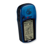
With the eTrex Legend, GARMIN has loaded a full basemap of North and South America into one small unit. The Legend is also designed to provide precise GPS positioning using correction data obtained from the Wide Area Augmentation System (WAAS). This product will provide position accuracy to less than three meters when receiving WAAS corrections.Minimize
Manufacturer:Garmin Product MPN MPN | ETREX LEGEND | Key Features GPS Type | Handheld (Outdoor) | Form Factor | Handheld | Map capabilities | Internal, Download maps | Enhanced accuracy | WAAS enabled | Input Method | Thumb Stick | Receiver Type | 12 Channels | Screen Size | 2.4 in. | Display Display Size | 1.1 in. x 2.1 in. | Display Type | LCD Display | Technical Features Special Features | Waypoint Icons | Trip calculator | Maximum speed, Current speed, Trip Timers, Time of sunrise/sunset, Track Log, Points-of-Interest (POI) | Included Software/Maps | Marine Cartography, City Navigation Maps, North America Maps, Europe Maps, Australia Maps, South Africa Maps, South America Maps, Middle East Maps, Asia Maps | Grids | Lat/Lon, MGRS, UTM, Loran TD position format, Maidenhead | Other Features PC Interface | Serial RS-232, NMEA-0183 | Built in memory | 8 MB | Environmental Protection | IPX7 Waterproof Standard | Antenna | Built-in | GPS System Accuisition Time - Cold | 45 sec | Accuisition Time - Initial Time | 15 sec | Update rate | 1 per second, continuous | Max. Horizontal accuracy | | Enhanced position accuracy | | Differential standards | DGPS Ready | Number of routes | 20 | Waypoints | 1000 | Battery Battery Type and Quantity | 2 x AA Batteries | Battery Life | 18 Hours | Warranty Warranty | 1 Year | Dimensions Width | 2 in. | Depth | 1.2 in. | Height | 4.4 in. | Weight | 0.33 lb. | Miscellaneous Family Line | Garmin eTrex | UPC | 753759030186 |
Tags:garmin, etrex, legend,
| Navman NavPix N40i$80.00 to $230.00
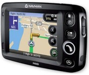
The N40i includes an integrated digital camera for taking NavPix to create an unmistakeable reminder of your chosen destination. So you can find your way there - no matter how far away it is – whenever you want.
Manufacturer:Navman Product MPN MPN | N40i | Key Features GPS Type | Automobile | Input Method | Touch Screen | Display Display Size | 3.5 in. | Display Type | LCD Display | Technical Features Audible Features | Voice Navigation Instructions | Included Software/Maps | USA Maps, Europe Maps, Australia Maps, Ireland | Other Features PC Interface | USB 1.1 | Built in memory | 64 MB | GPS System Update rate | 1 per second, continuous | Battery Battery Type and Quantity | Rechargeable Li-Ion Battery | Battery Life | 5 Hours | Dimensions Width | 4.65 in. | Depth | 0.89 in. | Height | 3.19 in. | Weight | 0.44 lb. | Miscellaneous UPC | 817186001376 |
Tags:navman, navpix, n40i,
| GlobalSat BT-359$40.00 to $90.00
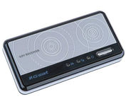
The GlobalSat BT-359 Bluetooth GPS receiver is our solution of the line Bluetooth GPS, which have both stylish and functional in true GlobalSat tradition. Taking its design criteria from the market leading BT-338 we have pushed the limits of GPS even further with greater sensitivity, more accuracy, and longer battery life than ever beforeMinimize
Manufacturer:GlobalSat Product MPN MPN | BT-359 | Key Features GPS Type | Handheld (Outdoor) | Form Factor | Wireless Receiver Module | Enhanced accuracy | WAAS enabled, EGNOS enabled | Receiver Type | 20 Channels | Other Features PC Interface | NMEA-0183, Bluetooth | Antenna | Built-in | GPS System Accuisition Time - Cold | 42 sec | Accuisition Time - Initial Time | 38 sec | Accuisition Time - Hot | 1 sec | Max. Horizontal accuracy | Battery | Battery Type and Quantity | Proprietary Lithium | Battery Life | 11 Hours | Dimensions Width | 3.23 in. | Depth | 0.53 in. | Height | 1.61 in. | Miscellaneous UPC | 4043619603046 |
Tags:globalsat, bt-359,
|
The handheld mapping GPS designed by hunters for hunters lets you follow the big game in color with 16-channel GPS precision. The iFINDER® Hunt C with color display offers everything you'd expect in a versatile, precision mapping GPS unit made for the field, including hunting-specific icons, unique "Scout Mode", electronic compass, barometric altimeter, built-in microphone, and more.Minimize
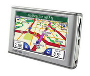
The Garmin nuvi 650 isn’t just a portable GPS system; it’s a fully featured multimedia device capable of MP3 playback and JPEG picture viewing. The nuvi 650 comes preloaded with City Navigator NT street maps that are loaded with hundreds of useful points of interest including gas stations, restaurants, and movie theaters. The touch screen interface gives you quick and easy access the nuvi 650’s many functions, and with the slim, sleek design you can easily stow it in your purse, backpack, or pocket. A rechargeable lithium-ion battery makes it suitable for navigation while in the car or even on foot.Minimize
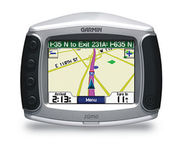
Designed specifically for motorcycles, the Garmin zumo 550 has a host of features that make it the easiest way to get GPS navigation on two wheels. Durable, waterproof, and built with fuel-resistant plastics, the zumo 550 can take a beating and hold up against even the most intense driving conditions. Right out of the box you’ll be able to chart out your ride with preloaded City Navigator NT street maps that are loaded with useful points of interest including restaurants, gas stations, and motels. Turn-by-turn voice directions keep you on track and with real-time traffic and weather updates you can avoid obstacles that might interfere with your otherwise, easy ride.Minimize
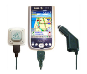
Compatible with most Pocket PCs with a CompactFlash slot, the Pharos Pocket GPS Navigator with CompactFlash inlcludes Pharos' iGPS-360 convertible receiver with a CompactFlash adaptor.Use it directly connected to the CompactFlash Adaptor, or for added flexibilty use the CF extension cable for placement and reception.Threre is no need for an external antenna!With Ostia, Pharos' award-winning navigation software installed on your Pocket PC, you can drive or walk through any city in the US, and locate your current position or quickly find a destination or point of interest. Routes can be calculated and viewed. The automated voice prompts will instruct you when and where to turn. If by chance you go "off-route," the automated voice will give an off-route warning and the system will automatically reroute you to your destination from your current position. Minimize