Garmin GPS 18$48.00 to $169.00
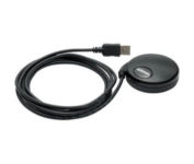
Turn your laptop PC into a powerful street navigator with the GPS 18 a GPS sensor bundled with nRoute and City Select software that automatically guides you with turn-by-turn directions and voice prompts to get you safely to your destination.
Manufacturer:Garmin Product MPN MPN | 010-00321-54 | Key Features GPS Type | Handheld (Outdoor) | Form Factor | Handheld, Plug-in | Map capabilities | Download maps | Enhanced accuracy | WAAS enabled | Receiver Type | 12 Channels | Technical Features Audible Features | Voice Navigation Instructions | Trip calculator | Points-of-Interest (POI) | Included Software/Maps | North America Maps, Europe Maps, South America Maps | Other Features PC Interface | USB 2.0, USB | GPS System Accuisition Time - Cold | 45 sec | Accuisition Time - Initial Time | 15 sec | Update rate | 1 per second, continuous | Max. Horizontal accuracy | | Enhanced position accuracy | | Differential standards | DGPS Ready | Warranty Warranty | 1 Year | Dimensions Width | 2.4 in. | Depth | 2.4 in. | Height | 0.77 in. | Weight | 0.22 lb. | Miscellaneous Family Line | Garmin GPS | UPC | 753759042714 |
Tags:garmin, gps, 18,
| Garmin StreetPilot c580$270.00 to $940.00
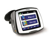
Receive door-to-door directions while staying on top of weather, traffic and localized information with the StreetPilot c580. Similar to the c550, StreetPilot c580 comes with hands-free calling, preloaded maps and an MP3 player, then takes it up a notch by adding dynamic content from MSN® Direct.
Manufacturer:Garmin Product MPN MPN | 010-00522-06 | Key Features GPS Type | Automobile | Form Factor | Fixed | Map capabilities | Internal, Download maps | Enhanced accuracy | WAAS enabled, EGNOS enabled | Input Method | Touch Screen | Receiver Type | 18 Channels | Screen Size | 3.5 in. | Display Display Size | 2.8 in. x 2.1 in. | Display Type | 16-bit Color LCD TFT Display | Resolutions | 320 X 240 | Technical Features Special Features | MP3 Player, JPEG Image Viewer, 3D Map View | Trip calculator | Shortest time, Maximum speed, Current speed, Route Recalculation, Points-of-Interest (POI) | Included Software/Maps | North America Maps, Canada Maps, Europe Maps, Australia Maps, South Africa Maps, South America Maps, Middle East Maps, Great Britain | Other Features PC Interface | USB | Expansion Slot Type | SD (Secure Digital) Card Slot | Antenna | Built-in, External Antenna Hookup | GPS System Accuisition Time - Cold | 38 sec | Accuisition Time - Initial Time | 1 sec | Update rate | 1 per second, continuous | Waypoints | 500 | PDA Features Compatible PDA OS | Windows 2000 | Compatible Devices | Notebook | Battery Battery Type and Quantity | Proprietary Li-Ion | Battery Life | 8 Hours | Warranty Warranty | 1 Year | Dimensions Width | 4.4 in. | Depth | 2.2 in. | Height | 3.2 in. | Weight | 0.59 lb. | Miscellaneous Family Line | Garmin StreetPilot | UPC | 753759068004 |
Tags:garmin, streetpilot, c580,
| Garmin nuvi 255W$100.00 to $455.00
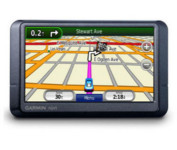
Go wide and get peace of mind with nuvi 255W. This affordable, widescreen navigator leads the way with voice-prompted turn-by-turn directions that speak street names and optional MSN Direct® services to get you there on time and keep you informed. It's packed with millions of destinations and maps for North America or Europe. Like the rest of the sleek nüvi 2x5-series, this portable navigator is priced right and ultra-easy to use.Minimize
Manufacturer:Garmin Product MPN MPN | 010-00718-20 | Key Features GPS Type | Automobile | Form Factor | Fixed | Map capabilities | Internal | Input Method | Touch Screen, Keyboard | Screen Size | 4.4 in. | Display Display Size | 3.81 in. x 2.25 in. | Display Type | LCD TFT Display | Resolutions | 480 x 272 | Technical Features Special Features | JPEG Image Viewer, Converter, Calculator, 3D Map View | Audible Features | Spoken Street Names | Trip calculator | Detour Feature, Points-of-Interest (POI) | Included Software/Maps | North America Maps, Europe Maps | Other Features PC Interface | USB | Expansion Slot Type | SD (Secure Digital) Card Slot | GPS System Waypoints | 1000 | PDA Features Plug-in Interface | Secure Digital (SD) | Compatible PDA OS | Windows 2000 | Compatible Devices | Notebook | Battery Battery Type and Quantity | Rechargeable Li-Ion Battery | Battery Life | 4 Hours | Dimensions Width | 4.8 in. | Depth | 0.8 in. | Height | 2.9 in. | Weight | 0.33 lb. | Miscellaneous Family Line | Garmin nuvi | UPC | 753759077600 |
Tags:garmin, nuvi, 255w,
|
You'll give your Kenwood in-dash mobile video system a potent extra dimension when you connect the KNA-G510 navigation system. You'll drive with confidence as it guides you to your destination efficiently and accurately. The system can even keep you up to date on what's happening with traffic flow along your programmed route.Minimize
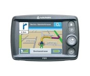
The F20, provides you with a lot for very little. Loaded with features normally found in other, more expensive car navigators, the F20 packs them all into a neat, pocket-sized compact unit. It’s the advanced features that separate the F20 from other entry-level navigators. The ‘Nearest Parking and Petrol’ buttons, previously only found on our more expensive models, are a simple but brilliant idea, exclusive to Navman.Minimize
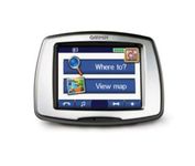
From Garmin, the leader in portable GPS solutions, the StreetPilot c550 is easy to use, and rich with features. The StreetPilot c550 comes preloaded with City Navigator NT street maps and includes a large database of points of interest including motels, restaurants, gas stations, and grocery stores. The simple touch screen interface gives you excellent control over menus and settings, and with Bluetooth support, you can even use the c550 for hands-free calling using the built-in speaker and microphone.Minimize

The GP-7000F/NT is a GPS/WAAS plotter designed for a variety of vessels desiring video plotting and echo sounding capabilities. With the GP-7000 series, you can see the highly accurate position of your boat on the chart. The GP-7000 series has four display modes: Course Plot, Nav Data, Steering, and Highway modes. The course plot mode is useful for obtaining general information about surrounding sea areas. The Nav data mode clearly shows important navigational information with large text, which is easy to see even from a distance. The steering mode and highway mode assist the operator in following a predetermined route.Minimize