Garmin GPS 18$48.00 to $169.00
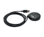
Turn your laptop PC into a powerful street navigator with the GPS 18 a GPS sensor bundled with nRoute and City Select software that automatically guides you with turn-by-turn directions and voice prompts to get you safely to your destination.
Manufacturer:Garmin Product MPN MPN | 010-00321-54 | Key Features GPS Type | Handheld (Outdoor) | Form Factor | Handheld, Plug-in | Map capabilities | Download maps | Enhanced accuracy | WAAS enabled | Receiver Type | 12 Channels | Technical Features Audible Features | Voice Navigation Instructions | Trip calculator | Points-of-Interest (POI) | Included Software/Maps | North America Maps, Europe Maps, South America Maps | Other Features PC Interface | USB 2.0, USB | GPS System Accuisition Time - Cold | 45 sec | Accuisition Time - Initial Time | 15 sec | Update rate | 1 per second, continuous | Max. Horizontal accuracy | | Enhanced position accuracy | | Differential standards | DGPS Ready | Warranty Warranty | 1 Year | Dimensions Width | 2.4 in. | Depth | 2.4 in. | Height | 0.77 in. | Weight | 0.22 lb. | Miscellaneous Family Line | Garmin GPS | UPC | 753759042714 |
Tags:garmin, gps, 18,
| Pharos Science PF080$89.00 to $241.00
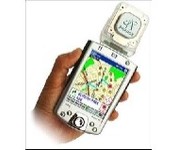
Pharos, the leader in advanced, affordable navigation solutions for handheld computing, has created the ultimate navigation tool for Windows Mobile-based Pocket PCs and mobile devices. Use Pharos Pocket GPS Navigator with CompactFlash to navigate door-to-door or point-to-point. Use it for hiking, walking tours or other outdoor activities. With audio voice prompts to guide you to your destination, the Pocket GPS Navigator is great for your car, too. In fact, the Pharos GPS Navigator performs just like more expensive, factory-installed, in-vehicle navigation systems, at a fraction of the cost yet, its easy to load into your Pocket PC and simple to use.Minimize
Manufacturer:Pharos Science Product MPN MPN | pf080 | Key Features GPS Type | Automobile | Form Factor | Handheld | Map capabilities | Download maps | Enhanced accuracy | WAAS enabled, EGNOS enabled | Receiver Type | 12 Channels | Technical Features Special Features | Compass | Audible Features | Voice Navigation Instructions | Trip calculator | Real-time Traffic Reports, Points-of-Interest (POI) | Other Features PC Interface | NMEA-0183 | Expansion Slot Type | Compact Flash (CF) | Antenna | Built-in | GPS System Accuisition Time - Cold | 60 sec | Accuisition Time - Initial Time | 40 sec | Accuisition Time - Hot | 5 sec | Update rate | 1 per second, continuous | Max. Horizontal accuracy | PDA Features | Plug-in Interface | Compact Flash (CF) | Dimensions Width | 1.93 in. | Depth | 0.63 in. | Height | 2.17 in. | Weight | 0.09 lb. | Miscellaneous UPC | 818948001030 |
Tags:pharos, science, pf080,
| Garmin StreetPilot c530$180.00

StreetPilot c530 comes ready to go right out of the box with preloaded City Navigator® NT street maps and a hefty points of interest (POIs) database, including motels, restaurants, fuel, ATMs and more. Simply touch the super-bright sunlight-readable color screen to enter a destination, and the c530 takes you there with 2D or 3D maps and turn-by-turn voice directions. In addition, the c530 accepts custom points of interest (POIs) such as school zones and safety cameras and lets you set proximity alerts to warn you of upcoming POIs.Minimize
Manufacturer:Garmin Product MPN MPN | STREETC530 | Key Features GPS Type | Automobile | Form Factor | Fixed | Map capabilities | Internal, Map cartridges / Data cards | Input Method | Touch Screen | Screen Size | 3.5 in. | Display Display Size | 2.8 in. x 2.1 in. | Display Type | LCD TFT Display | Resolutions | 320 X 240 | Technical Features Special Features | Audio Book Player | Trip calculator | Shortest time, Shortest distance, Route Recalculation, Avoid toll roads | Included Software/Maps | North America Maps | Other Features PC Interface | USB, Bluetooth | Expansion Slot Type | SD (Secure Digital) Card Slot | GPS System Waypoints | 500 | PDA Features Plug-in Interface | Secure Digital (SD) | Compatible PDA OS | Windows 2000 | Compatible Devices | Notebook | Battery Battery Type and Quantity | Rechargeable Li-Ion Battery | Battery Life | 8 Hours | Dimensions Width | 4.4 in. | Depth | 2.25 in. | Height | 3.2 in. | Weight | 0.56 lb. | Miscellaneous Family Line | Garmin StreetPilot | UPC | 053759054473 |
Tags:garmin, streetpilot, c530,
|

This preloaded, offshore chartplotter combines the power of networking with brilliant color and slim-line design. The GPSMAP 4212 has preloaded BlueChart® g2 maps of the U.S. coast and displays them on a whopping 12.1” XGA display with crisp, video-quality resolution. By connecting to the Garmin Marine Network, you can add sonar, radar and weather. For even more enhanced features, you can add the optional Bluechart g2 Vision card.Minimize

The new GP37 DGPS/WAAS Navigator is compact in size, yet big on power, features and performance. This waterproof unit is perfect for a wide range of boats. It is equipped with a WAAS and a DGPS receiver as standard supply. It utilizes both WAAS and differential radio beacon correction methods to give you the most accurate position fix available. The GP37 offers extremely accurate position fixes -- 10m for basic GPS, 5m or better with DGPS and 3m or better where WAAS service is available. It should be noted that DGPS is more reliable and accurate, as the WAAS system is still currently under development. There is no guarantee of accuracy, integrity, continuity or availability of the WAAS signal. For that reason, the GP37 runs with DGPS as the default setting in auto selection mode. In this mode, if the DGPS signal can not be received for any reason, the WAAS mode is automatically selected. Manual setting is also available. The display modes include Plotter, two Customizable displays, Steering, Highway and SpeedMinimize

The eTrex Summit comes on the heels of the extremely popular eTrex, which was designed for both marine and recreation use. This new all-in-one navigation device for the outdoor enthusiast is the first combination GPS, altimeter, and electronic compass. The electronic compass provides bearing information when you're standing still and the altimeter determines precise altitude, so you can tell how high you've climbed and your rate of ascent. Like its predecessor, the eTrex Summit boasts a powerful 12 parallel channel GPS receiver and comes packaged in a small, sleek case with operating buttons located on either side of the unit. The case is completely waterproof to withstand immersion in one meter of water for up to 30 minutes.Minimize

One of the first things a boater will notice about the Chart Master V6 series is their vertically oriented high-definition (234x320 pixel) six-inch super-bright color LCD displays. They provide clear visibility even in full sunlight, and the Chart Master V6I, with it's built-in GPS antenna is a great choice for boats with open cockpits, center consoles and flying bridges and can serve well as a back-up unitMinimize