Garmin GPS 18$48.00 to $169.00
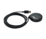
Turn your laptop PC into a powerful street navigator with the GPS 18 a GPS sensor bundled with nRoute and City Select software that automatically guides you with turn-by-turn directions and voice prompts to get you safely to your destination.
Manufacturer:Garmin Product MPN MPN | 010-00321-54 | Key Features GPS Type | Handheld (Outdoor) | Form Factor | Handheld, Plug-in | Map capabilities | Download maps | Enhanced accuracy | WAAS enabled | Receiver Type | 12 Channels | Technical Features Audible Features | Voice Navigation Instructions | Trip calculator | Points-of-Interest (POI) | Included Software/Maps | North America Maps, Europe Maps, South America Maps | Other Features PC Interface | USB 2.0, USB | GPS System Accuisition Time - Cold | 45 sec | Accuisition Time - Initial Time | 15 sec | Update rate | 1 per second, continuous | Max. Horizontal accuracy | | Enhanced position accuracy | | Differential standards | DGPS Ready | Warranty Warranty | 1 Year | Dimensions Width | 2.4 in. | Depth | 2.4 in. | Height | 0.77 in. | Weight | 0.22 lb. | Miscellaneous Family Line | Garmin GPS | UPC | 753759042714 |
Tags:garmin, gps, 18,
| Furuno GP37$609.00 to $695.00

The new GP37 DGPS/WAAS Navigator is compact in size, yet big on power, features and performance. This waterproof unit is perfect for a wide range of boats. It is equipped with a WAAS and a DGPS receiver as standard supply. It utilizes both WAAS and differential radio beacon correction methods to give you the most accurate position fix available. The GP37 offers extremely accurate position fixes -- 10m for basic GPS, 5m or better with DGPS and 3m or better where WAAS service is available. It should be noted that DGPS is more reliable and accurate, as the WAAS system is still currently under development. There is no guarantee of accuracy, integrity, continuity or availability of the WAAS signal. For that reason, the GP37 runs with DGPS as the default setting in auto selection mode. In this mode, if the DGPS signal can not be received for any reason, the WAAS mode is automatically selected. Manual setting is also available. The display modes include Plotter, two Customizable displays, Steering, Highway and SpeedMinimize
Manufacturer:Furuno Product MPN MPN | GP37 | Key Features GPS Type | Marine | Form Factor | Fixed | Enhanced accuracy | WAAS enabled | Receiver Type | 12 Channels | Screen Size | 4.4 in. | Display Display Size | 3.74 in. x 2.36 in. | Display Type | LCD Display | Technical Features Audible Features | Anchor Alarm, Arrival Alarm, Clock Alarm | Grids | Lat/Lon, Loran TD position format | Other Features PC Interface | Serial RS-232 | GPS System Accuisition Time - Initial Time | 20 sec | Max. Horizontal accuracy | | Enhanced position accuracy | | Differential standards | DGPS Ready | Number of routes | 50 | Waypoints | 999 | Miscellaneous UPC | 611679266842 |
Tags:furuno, gp37,
| Garmin StreetPilot i5$181.00 to $450.00

It may be tiny, but the StreetPilot i5 is packed with state-of-the-art navigation features. The StreetPilot i5 comes preloaded with incredibly detailed City Navigator NT street maps that are packed with nearly 6 million points of interest including hotels, restaurants, ATMs and much more. A simple rolling-wheel interface allows you to quickly adjust settings and alter routes to your destination. Built for portability and power, the StreetPilot i5 is a cost effective portable GPS solution. Minimize
Manufacturer:Garmin Product MPN MPN | SPI5 | Key Features GPS Type | Automobile | Form Factor | Handheld | Enhanced accuracy | WAAS enabled | Receiver Type | 12 Channels | Screen Size | 2.1 in. | Display Display Size | 1.7 in. x 1.3 in. | Display Type | 32k Colors LCD TFT Display | Resolutions | 220 x 176 | Technical Features Audible Features | Voice Navigation Instructions | Trip calculator | Detour Feature, Points-of-Interest (POI) | Other Features PC Interface | USB | Battery Battery Type and Quantity | 2 x AA Batteries | Battery Life | 7 Hours | Dimensions Width | 3 in. | Depth | 2.15 in. | Height | 2.74 in. | Weight | 0.32 lb. | Miscellaneous Family Line | Garmin StreetPilot | UPC | 840356505404 |
Tags:garmin, streetpilot, i5,
|
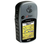
The eTrex Legend Cx is loaded with the same popular features found in the eTrex Legend C, including sunlight-readable color and advanced GPS routing capabilities — all in a waterproof design. In addition, it comes with a blank 32 MB microSD card for storage of optional map detail. Download maps directly to the card or purchase microSD cards preloaded with MapSource® Topo and inland lake maps, BlueChart® marine cartography, and City Navigator™ street maps.Minimize

One of the first things a boater will notice about the Chart Master V6 series is their vertically oriented high-definition (234x320 pixel) six-inch super-bright color LCD displays. They provide clear visibility even in full sunlight, and the Chart Master V6I, with it's built-in GPS antenna is a great choice for boats with open cockpits, center consoles and flying bridges and can serve well as a back-up unitMinimize
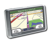
Wide and way cool, nüvi 200W shows you the way with detailed maps on a bright widescreen display and clear, voice-prompted directions. This stylish navigator and travel companion comes with preloaded maps for the lower 48 states, Hawaii and Puerto Rico or regional coverage in other areas. Like the rest of the nüvi 200-series, nüvi 200W is affordably priced and simple to use.Minimize

The GPS 76 is designed to provide precise GPS positioning using correction data obtained from the Wide Area Augmentation System (WAAS). This unit features a built-in quad helix antenna for superior reception and can provide position accuracy to less than three meters when receiving WAAS corrections.The GPS 76 provides 1 megabyte of internal user memory to be used for storing downloaded Points of Interest data. This 1 megabyte of storage area is preloaded from the factory with worldwide cities (populations greater than 200,000) and nautical navigation aids such as lights, buoys, sound signals and day beacons, and is perfect for downloading points of interest detail from GARMIN's line of MapSource CD-ROMs. The GPS 76 is also preloaded with tide data for the United States.Minimize