Products reviews

Garmin GPS 18

$48.00 to $169.00


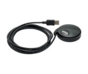
Turn your laptop PC into a powerful street navigator with the GPS 18 a GPS sensor bundled with nRoute and City Select software that automatically guides you with turn-by-turn directions and voice prompts to get you safely to your destination.

Manufacturer:Garmin Product MPNKey FeaturesTechnical FeaturesOther FeaturesGPS SystemWarrantyDimensionsMiscellaneous
MPN010-00321-54
GPS Type   Handheld (Outdoor)
Form FactorHandheld, Plug-in
Map capabilities   Download maps
Enhanced accuracyWAAS enabled
Receiver Type12 Channels
Audible Features   Voice Navigation Instructions
Trip calculator   Points-of-Interest (POI)
Included Software/Maps   North America Maps, Europe Maps, South America Maps
PC InterfaceUSB 2.0, USB
Accuisition Time - Cold45 sec
Accuisition Time - Initial Time15 sec
Update rate1 per second, continuous
Max. Horizontal accuracy   Enhanced position accuracy Differential standardsDGPS Ready
Warranty1 Year
Width2.4 in.
Depth2.4 in.
Height0.77 in.
Weight0.22 lb.
Family LineGarmin GPS
UPC753759042714


Tags:

garmin, gps, 18,

Garmin Rino 110

$140.00 to $226.00


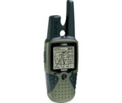
The Rino 110 is a GPS-enabled handheld that integrates radio functionality to provide two-way communications. It's waterproof, can send communications up to five miles (using GMRS channels), and can "beam" your exact location to another Rino user within a two-mile range (on the FRS spectrum) using "Position Reporting". And because the Rino 110 has standard FRS capabilities, you can talk to friends or family who own conventional FRS radios.The Rino 110 has a built-in city point data base, with 1 MB of internal memory for additional points-of-interest data that can be downloaded from a MapSource Points of Interest CD-ROM.Minimize

Manufacturer:Garmin Product MPNKey FeaturesDisplayTechnical FeaturesOther FeaturesGPS SystemBatteryWarrantyDimensionsMiscellaneous
MPN010-N0270-00
GPS Type   Handheld (Outdoor)
Form FactorHandheld
Map capabilities   Internal, Download maps
Enhanced accuracyWAAS enabled
Input Method   Keypad
Receiver Type12 Channels
Screen Size2 in.
Display Size1.4 in. x 1.4 in.
Display TypeLCD Display
Resolutions160 X 160
Special Features   Waypoint Icons
Trip calculator   Maximum speed, Current speed, Points-of-Interest (POI)
Grids   Lat/Lon, MGRS, UTM, Loran TD position format, Maidenhead
PC InterfaceSerial RS-232, NMEA-0183
Built in memory1 MB
Environmental ProtectionIPX7 Waterproof Standard
AntennaQuadrifilar Helix
Accuisition Time - Cold45 sec
Accuisition Time - Initial Time15 sec
Update rate1 per second, continuous
Max. Horizontal accuracy   Enhanced position accuracy Differential standardsDGPS Ready
Number of routes20
Waypoints   500
Battery Type and Quantity3 x AA Batteries
Battery Life28 Hours
Warranty1 Year
Width2.3 in.
Depth1.6 in.
Height4.5 in.
Weight0.48 lb.
Family LineGarmin Rino
UPC689076139793


Tags:

garmin, rino, 110,

Garmin Rino 120

$167.00 to $628.00


The Rino 120 is state-of-the-art GPS navigation and two-way communications combined, with enough memory to download detailed mapping for driving, hiking, hunting, fishing--or just about anything else you can dream up.

Manufacturer:Garmin Product MPNKey FeaturesDisplayTechnical FeaturesOther FeaturesGPS SystemBatteryWarrantyDimensionsMiscellaneous
MPNRINO120
GPS Type   Handheld (Outdoor)
Form FactorHandheld
Map capabilities   Internal, Download maps
Enhanced accuracyWAAS enabled
Input Method   Thumb Stick
Receiver Type12 Channels
Screen Size2 in.
Display Size1.4 in. x 1.4 in.
Display TypeLCD Display
Resolutions160 X 160
Marine FeaturesFishing Calcluator
Special Features   Waypoint Icons
Audible Features   Proximity Alarm
Trip calculator   Maximum speed, Current speed, Trip Timers, Time of sunrise/sunset, Track Log, Points-of-Interest (POI)
Included Software/Maps   Marine Cartography, North America Maps, South America Maps
Grids   Lat/Lon, MGRS, UTM, Loran TD position format, Maidenhead
PC InterfaceSerial RS-232, NMEA-0183
Environmental ProtectionIPX7 Waterproof Standard
AntennaQuadrifilar Helix
Accuisition Time - Cold45 sec
Accuisition Time - Initial Time15 sec
Update rate1 per second, continuous
Max. Horizontal accuracy   Enhanced position accuracy Differential standardsDGPS Ready
Number of routes20
Waypoints   500
Battery Type and Quantity3 x AA Batteries
Battery Life28 Hours
Warranty1 Year
Width2.3 in.
Depth1.6 in.
Height4.5 in.
Weight0.48 lb.
Family LineGarmin Rino
UPC689076630887


Tags:

garmin, rino, 120,


Garmin Edge 305


Rugged, lightweight Edge attaches easily to the stem or handlebars of your bike with the included bike mount. Just turn it on, acquire GPS satellites and go. Edge 305 automatically measures your speed, distance, time, calories burned, altitude, climb and descent, and also records the route you have taken for review. For extra-precise climb and descent data, Edge 305 also incorporates a barometric altimeter to pinpoint changes in elevation.Minimize


Pharos Science iGPS-360
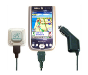

Compatible with most Pocket PCs with a CompactFlash slot, the Pharos Pocket GPS Navigator with CompactFlash inlcludes Pharos' iGPS-360 convertible receiver with a CompactFlash adaptor.Use it directly connected to the CompactFlash Adaptor, or for added flexibilty use the CF extension cable for placement and reception.Threre is no need for an external antenna!With Ostia, Pharos' award-winning navigation software installed on your Pocket PC, you can drive or walk through any city in the US, and locate your current position or quickly find a destination or point of interest. Routes can be calculated and viewed. The automated voice prompts will instruct you when and where to turn. If by chance you go "off-route," the automated voice will give an off-route warning and the system will automatically reroute you to your destination from your current position. Minimize


Garmin GPS 72


The GPS 72 is a low-cost solution for land or marine navigation designed to provide precise GPS positioning using correction data obtained from the Wide Area Augmentation System (WAAS). The GPS 72 can provide position accuracy to less than three meters when receiving WAAS corrections. This rugged, waterproof, unsinkable GPS receiver offers a large, 4-level grayscale screen. It's designed as the next generation in basic, entry-level GARMIN GPS.Minimize


Garmin eTrex Legend
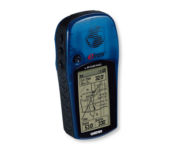

With the eTrex Legend, GARMIN has loaded a full basemap of North and South America into one small unit. The Legend is also designed to provide precise GPS positioning using correction data obtained from the Wide Area Augmentation System (WAAS). This product will provide position accuracy to less than three meters when receiving WAAS corrections.Minimize