Garmin zumo 550$544.00 to $1,300.00
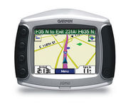
Designed specifically for motorcycles, the Garmin zumo 550 has a host of features that make it the easiest way to get GPS navigation on two wheels. Durable, waterproof, and built with fuel-resistant plastics, the zumo 550 can take a beating and hold up against even the most intense driving conditions. Right out of the box you’ll be able to chart out your ride with preloaded City Navigator NT street maps that are loaded with useful points of interest including restaurants, gas stations, and motels. Turn-by-turn voice directions keep you on track and with real-time traffic and weather updates you can avoid obstacles that might interfere with your otherwise, easy ride.Minimize
Manufacturer:Garmin Product MPN MPN | 901050 | Key Features GPS Type | Handheld (Outdoor) | Form Factor | Fixed | Map capabilities | Internal | Enhanced accuracy | WAAS enabled | Input Method | Touch Screen | Screen Size | 3.5 in. | Display Display Size | 2.8 in. x 2.1 in. | Display Type | 16-bit Color LCD Display | Resolutions | 320 X 240 | Technical Features Special Features | Waypoint Icons, MP3 Player, 3D Map View | Audible Features | Voice Navigation Instructions | Trip calculator | Maximum speed, Odometer, Route Recalculation, Trip Timers, Detour Feature, Points-of-Interest (POI) | Included Software/Maps | North America Maps, Europe Maps | Other Features PC Interface | USB 2.0, Bluetooth | Environmental Protection | IPX7 Waterproof Standard | Antenna | Built-in, External Antenna Hookup | GPS System Waypoints | 500 | Battery Battery Type and Quantity | Proprietary Li-Ion | Battery Life | 4 Hours | Warranty Warranty | 1 Year | Dimensions Width | 4.8 in. | Depth | 1.6 in. | Height | 3.9 in. | Weight | 0.66 lb. | Miscellaneous UPC | 753759061753 |
Tags:garmin, zumo, 550,
| Garmin GPSMAP 276C$615.00 to $1,000.00
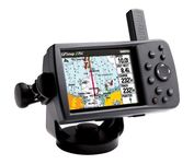
This portable GPS navigator features a 256-color TFT display that's easy to read in bright sun along with a built-in basemap and auto routing to provide you with turn-by-turn directions to the marina for a day of boating.
Manufacturer:Garmin Product MPN MPN | 010-00331-00 | Key Features GPS Type | Automobile | Form Factor | Fixed | Map capabilities | Internal, Map cartridges / Data cards | Enhanced accuracy | WAAS enabled | Input Method | Keypad | Receiver Type | 12 Channels | Display Display Size | 3.8 in. | Display Type | 256 Color LCD TFT Display | Resolutions | 480 X 320 | Technical Features Marine Features | Chart Plotter | Audible Features | Proximity Alarm, Anchor Alarm, Arrival Alarm, Off-Course Alarm, Clock Alarm | Trip calculator | Points-of-Interest (POI) | Included Software/Maps | North America Maps, Canada Maps, Europe Maps | Grids | Lat/Lon, MGRS, User Grid, UTM, Loran TD position format, Maidenhead | Other Features PC Interface | USB | Environmental Protection | IPX7 Waterproof Standard | Antenna | Quadrifilar Helix | GPS System Accuisition Time - Cold | 45 sec | Accuisition Time - Initial Time | 15 sec | Update rate | 1 per second, continuous | Max. Horizontal accuracy | | Enhanced position accuracy | | Differential standards | DGPS Ready | Number of routes | 50 | Waypoints | 3000 | Battery Battery Type and Quantity | Proprietary Lithium | Battery Life | 15 Hours | Warranty Warranty | 1 Year | Dimensions Width | 5.7 in. | Depth | 1.9 in. | Height | 3.2 in. | Weight | 0.85 lb. | Miscellaneous Family Line | Garmin GPSMAP | UPC | 839438266340 |
Tags:garmin, gpsmap, 276c,
| Dual Electronics XNAV3550$219.00 to $228.00

The Dual XNA3550 features an easy to use touch screen graphic interface with MP3 playback capability. Turn-by-turn instructions with voice guidance. Visual left/right LED indicators. 3D Map view. Level selectable map view. Start route guidance search by:- Address/intersection- Points of interest- Address book- Recent destination. GPS status indicator.Minimize
Manufacturer:Dual Electronics Product MPN MPN | XNAV3550 | Key Features GPS Type | Automobile | Form Factor | Fixed | Map capabilities | Internal | Input Method | Touch Screen | Receiver Type | 12 Channels | Display Display Size | 3.5 in. | Display Type | 16.7M Colors LCD TFT Display | Resolutions | 320 X 240 | Technical Features Special Features | Address Book, MP3 Player, 3D Map View | Trip calculator | Route Recalculation, Points-of-Interest (POI) | Included Software/Maps | USA Maps | Other Features Built in memory | 64 MB | Expansion Slot Type | SD (Secure Digital) Card Slot | Antenna | Built-in | PDA Features Plug-in Interface | Secure Digital (SD) | Compatible PDA OS | Windows CE | Battery Battery Type and Quantity | Rechargeable Li-Ion Battery | Battery Life | 2 Hours | Dimensions Width | 5.25 in. | Depth | 1.25 in. | Height | 3.13 in. | Weight | 2.1 lb. | Miscellaneous UPC | 827204101636 |
Tags:dual, electronics, xnav3550,
|
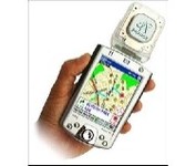
Pharos, the leader in advanced, affordable navigation solutions for handheld computing, has created the ultimate navigation tool for Windows Mobile-based Pocket PCs and mobile devices. Use Pharos Pocket GPS Navigator with CompactFlash to navigate door-to-door or point-to-point. Use it for hiking, walking tours or other outdoor activities. With audio voice prompts to guide you to your destination, the Pocket GPS Navigator is great for your car, too. In fact, the Pharos GPS Navigator performs just like more expensive, factory-installed, in-vehicle navigation systems, at a fraction of the cost yet, its easy to load into your Pocket PC and simple to use.Minimize

The GP-7000F/NT is a GPS/WAAS plotter designed for a variety of vessels desiring video plotting and echo sounding capabilities. With the GP-7000 series, you can see the highly accurate position of your boat on the chart. The GP-7000 series has four display modes: Course Plot, Nav Data, Steering, and Highway modes. The course plot mode is useful for obtaining general information about surrounding sea areas. The Nav data mode clearly shows important navigational information with large text, which is easy to see even from a distance. The steering mode and highway mode assist the operator in following a predetermined route.Minimize

It may be tiny, but the StreetPilot i5 is packed with state-of-the-art navigation features. The StreetPilot i5 comes preloaded with incredibly detailed City Navigator NT street maps that are packed with nearly 6 million points of interest including hotels, restaurants, ATMs and much more. A simple rolling-wheel interface allows you to quickly adjust settings and alter routes to your destination. Built for portability and power, the StreetPilot i5 is a cost effective portable GPS solution. Minimize

The eTrex Summit comes on the heels of the extremely popular eTrex, which was designed for both marine and recreation use. This new all-in-one navigation device for the outdoor enthusiast is the first combination GPS, altimeter, and electronic compass. The electronic compass provides bearing information when you're standing still and the altimeter determines precise altitude, so you can tell how high you've climbed and your rate of ascent. Like its predecessor, the eTrex Summit boasts a powerful 12 parallel channel GPS receiver and comes packaged in a small, sleek case with operating buttons located on either side of the unit. The case is completely waterproof to withstand immersion in one meter of water for up to 30 minutes.Minimize