Garmin GPSMAP 76Cx$233.00 to $432.00
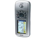
The GPSMAP 76CSx is a refreshing upgrade of the GPSMAP 76CS, one of our most popular models for outdoor and marine use. This unit features a removable microSD card for detailed mapping memory and a waterproof, rugged housing. The microSD card slot is located inside the waterproof battery compartment. Users can load map data and transfer routes and waypoints through the unit’s fast USB connection.Minimize
Manufacturer:Garmin Product MPN MPN | 010-00468-00 | Key Features GPS Type | Marine | Form Factor | Handheld | Map capabilities | Internal | Enhanced accuracy | WAAS enabled | Receiver Type | 12 Channels | Screen Size | 2.7 in. | Display Display Size | 1.5 in. x 2.2 in. | Display Type | 256 Color LCD TFT Display | Resolutions | 160 X 240 | Technical Features Marine Features | Fishing Calcluator, MOB (Man Over Board) | Special Features | Waypoint Icons | Audible Features | Proximity Alarm, Anchor Alarm, Arrival Alarm, Off-Course Alarm, Clock Alarm, Shallow/Deep Alarm | Trip calculator | Moving average, Total average, Odometer, Time of sunrise/sunset, Track Log, Points-of-Interest (POI) | Included Software/Maps | North America Maps, South America Maps | Grids | Lat/Lon, MGRS, User Grid, UTM, Loran TD position format, Maidenhead | Other Features PC Interface | USB, NMEA-0183 | Environmental Protection | IPX7 Waterproof Standard, High Impact Plastic Alloy Body | Antenna | Built-in, Quadrifilar Helix | GPS System Accuisition Time - Cold | 38 sec | Accuisition Time - Initial Time | 1 sec | Update rate | 1 per second, continuous | Max. Horizontal accuracy | | Enhanced position accuracy | | Differential standards | DGPS Ready | Number of routes | 50 | Waypoints | 1000 | Battery Battery Type and Quantity | 2 x AA Batteries | Battery Life | 18 Hours | Warranty Warranty | 1 Year | Dimensions Width | 2.7 in. | Depth | 1.4 in. | Height | 6.2 in. | Weight | 0.48 lb. | Miscellaneous Family Line | Garmin GPSMAP | UPC | 753759051631 |
Tags:garmin, gpsmap, 76cx,
| TomTom Navigator 3$150.00 to $160.00

Get moving with TomTom Navigator 3. The flexible and personal car navigation system works on your Pocket PC. TomTom Navigator 3 guides you effortlessly from door to door via the best route. Clear 3D colour maps and spoken instructions take the stress out of driving. Plan the best route when you have multiple stops: pick up colleagues on the way to a meeting or friends on the way to a restaurant. Route around areas you would like to avoid due to traffic jams or road works. The Major Roads of Europe feature makes planning and navigating international trips easier than ever. Plan the best route from Munich to Lyon, and TomTom will guide you there.Minimize
Manufacturer:TomTom Product MPN MPN | 1C90.080 | Key Features GPS Type | Handheld (Outdoor) | Form Factor | Handheld, Plug-in | Map capabilities | Internal, Download maps | Technical Features Audible Features | Voice Navigation Instructions | Trip calculator | Route Recalculation, Points-of-Interest (POI) | Included Software/Maps | Europe Maps | GPS System Accuisition Time - Cold | 51 sec | Accuisition Time - Initial Time | 37 sec | Accuisition Time - Hot | 3 sec | Waypoints | 1000 | PDA Features Compatible PDA OS | Pocket PC | Compatible Devices | Pocket PC Based PDA | Miscellaneous Family Line | Tomtom Navigator | UPC | 636926005876 |
Tags:tomtom, navigator, 3,
| Pharos Science PSD80$86.00 to $262.00
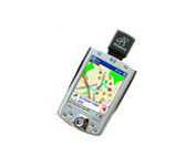
The Pharos Pocket GPS Navigator is an excellent navigation solution for your Dell Pocket PC. The package comes with a compact iGPS-SD receiver and the Ostia Smart Navigator software with detailed street-level maps of entire US. It even includes a car charger that powers the GPS while charging your Pocket PC simultaneously. The iGPS-SD receiver is a small, slim and sensitive GPS receiver that plugs in the Pocket PC's SDIO slot. Ostia helps you locate your current position, find a destination or point of interest (POI) and get a route to your destination. Simply activate the GPS navigation program and begin traveling; the automated voice-prompts will tell you when and where to turn. If by chance you go 'off route', the Pocket GPS Navigator will always reroute you to your destination from your current GPS position.Minimize
Manufacturer:Pharos Science Product MPN MPN | PSD80 | Key Features GPS Type | Handheld (Outdoor) | Form Factor | Plug-in | Map capabilities | Internal, Download maps | Receiver Type | 12 Channels | Technical Features Audible Features | Voice Navigation Instructions | Trip calculator | Real-time Traffic Reports, Points-of-Interest (POI) | Included Software/Maps | City Navigation Maps | Other Features PC Interface | NMEA-0183 | GPS System Accuisition Time - Cold | 8 sec | Accuisition Time - Initial Time | 45 sec | Accuisition Time - Hot | 60 sec | Max. Horizontal accuracy | PDA Features | Compatible PDA OS | Pocket PC | Compatible Devices | Pocket PC Based PDA | Dimensions Width | 1.2 in. | Depth | 0.55 in. | Height | 1.3 in. | Miscellaneous UPC | 818948001115 |
Tags:pharos, science, psd80,
|

It may be tiny, but the StreetPilot i5 is packed with state-of-the-art navigation features. The StreetPilot i5 comes preloaded with incredibly detailed City Navigator NT street maps that are packed with nearly 6 million points of interest including hotels, restaurants, ATMs and much more. A simple rolling-wheel interface allows you to quickly adjust settings and alter routes to your destination. Built for portability and power, the StreetPilot i5 is a cost effective portable GPS solution. Minimize
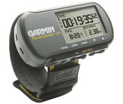
The Forerunner 101 offers athletes and recreational walkers and runners an entry-level personal training device with GPS. It has the same features as the Forerunner 201, but operates on two AAA batteries. The Forerunner 101 stores lap histories for up to two years to provide an archive of workout performance over time. Users can retrieve lap data for previous workouts by date, week, month, or over a specific time interval. For business travelers who want to train on the road, the Forerunner 101 also doubles as a navigator. Users can mark their hotel as a specific location, see their current position on the plotter display, and follow an electronic breadcrumb trail back to their starting point.Minimize
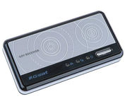
The GlobalSat BT-359 Bluetooth GPS receiver is our solution of the line Bluetooth GPS, which have both stylish and functional in true GlobalSat tradition. Taking its design criteria from the market leading BT-338 we have pushed the limits of GPS even further with greater sensitivity, more accuracy, and longer battery life than ever beforeMinimize

This preloaded, offshore chartplotter combines the power of networking with brilliant color and slim-line design. The GPSMAP 4212 has preloaded BlueChart® g2 maps of the U.S. coast and displays them on a whopping 12.1” XGA display with crisp, video-quality resolution. By connecting to the Garmin Marine Network, you can add sonar, radar and weather. For even more enhanced features, you can add the optional Bluechart g2 Vision card.Minimize