DeLorme Earthmate$142.00 to $550.00
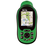
Never Get Lost Again When was the last time you wasted valuable travel time because you took a wrong turn in an unfamiliar location? Now there's an affordable and reliable solution - the new Earthmate GPS receiver. The small and flexible Earthmate GPS receiver is a high-performance, easy-to-use link to the satellite navigation technology of the Global Positioning System (GPS). Accessing these satellites is available for no additional charge. Earthmate, connected to a USB laptop PC, shows your real-time position on detailed Street Atlas USA maps anywhere in the U.S. (software included). You will always know where you are and where you need to go.Minimize
Manufacturer:DeLorme Product MPN MPN | AE-006761-201 | Key Features GPS Type | Automobile | Form Factor | Wireless Receiver Module | Map capabilities | Internal | Enhanced accuracy | WAAS enabled | Receiver Type | 12 Channels | Technical Features Included Software/Maps | USA Maps | Other Features PC Interface | USB | GPS System Accuisition Time - Cold | 45 sec | Max. Horizontal accuracy | | Enhanced position accuracy | PDA Features | Compatible PDA OS | Windows XP, Windows 2000, Windows ME, Windows 98SE | Compatible Devices | Notebook | Dimensions Width | 1.88 in. | Height | 2.09 in. |
Tags:delorme, earthmate,
| Bushnell NAV500$164.00 to $285.00
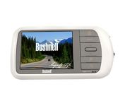
Bushnell has announced their entry into the portable auto GPS navigation market with the announcement of the Bushnell Nav 500. The Nav 500 offers many features found on other navigation devices in its class such as a 3.5 inch touch screen display, pre-installed maps of the USA and Canada, and an MP3 player.
Manufacturer:Bushnell Product MPN MPN | 36-5001 | Key Features GPS Type | Automobile | Form Factor | Fixed | Map capabilities | Internal, Map cartridges / Data cards, DVD | Enhanced accuracy | WAAS enabled | Input Method | Keypad, Touch Screen | Receiver Type | 20 Channels | Display Display Size | 3.5 in. | Display Type | LCD Display | Resolutions | 320 X 240 | Technical Features Marine Features | Split Screen | Special Features | Compass, MP3 Player | Audible Features | Voice Navigation Instructions | Trip calculator | Route Recalculation | Included Software/Maps | Canada Maps | Grids | Lat/Lon | Other Features PC Interface | USB, Bluetooth | Expansion Slot Type | SD (Secure Digital) Card Slot | Battery Battery Type and Quantity | Rechargeable Li-Ion Battery | Warranty Warranty | 1 Year | Dimensions Width | 5.63 in. | Depth | 0.91 in. | Height | 3 in. | Weight | 0.75 lb. | Miscellaneous UPC | 029757365002 |
Tags:bushnell, nav500,
| Garmin Rino 120$167.00 to $628.00
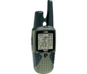
The Rino 120 is state-of-the-art GPS navigation and two-way communications combined, with enough memory to download detailed mapping for driving, hiking, hunting, fishing--or just about anything else you can dream up.
Manufacturer:Garmin Product MPN MPN | RINO120 | Key Features GPS Type | Handheld (Outdoor) | Form Factor | Handheld | Map capabilities | Internal, Download maps | Enhanced accuracy | WAAS enabled | Input Method | Thumb Stick | Receiver Type | 12 Channels | Screen Size | 2 in. | Display Display Size | 1.4 in. x 1.4 in. | Display Type | LCD Display | Resolutions | 160 X 160 | Technical Features Marine Features | Fishing Calcluator | Special Features | Waypoint Icons | Audible Features | Proximity Alarm | Trip calculator | Maximum speed, Current speed, Trip Timers, Time of sunrise/sunset, Track Log, Points-of-Interest (POI) | Included Software/Maps | Marine Cartography, North America Maps, South America Maps | Grids | Lat/Lon, MGRS, UTM, Loran TD position format, Maidenhead | Other Features PC Interface | Serial RS-232, NMEA-0183 | Environmental Protection | IPX7 Waterproof Standard | Antenna | Quadrifilar Helix | GPS System Accuisition Time - Cold | 45 sec | Accuisition Time - Initial Time | 15 sec | Update rate | 1 per second, continuous | Max. Horizontal accuracy | | Enhanced position accuracy | | Differential standards | DGPS Ready | Number of routes | 20 | Waypoints | 500 | Battery Battery Type and Quantity | 3 x AA Batteries | Battery Life | 28 Hours | Warranty Warranty | 1 Year | Dimensions Width | 2.3 in. | Depth | 1.6 in. | Height | 4.5 in. | Weight | 0.48 lb. | Miscellaneous Family Line | Garmin Rino | UPC | 689076630887 |
Tags:garmin, rino, 120,
|
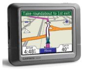
Packed with features and available in a variety of hip colors, the Garmin nuvi 250 is affordably priced and easy to use. The nuvi 250 comes preloaded with City Navigator map data giving you quick, turn-by-turn directions to anywhere in the continental United States. Pull up colorful, 2-D or 3-D maps on the sunlight-readable screen and voice directions will guide you safely and quickly to your selected destination. You can also set custom points of interest on the nuvi 250 such as your favorite restaurants or coffee shops, and with proximity alerts you’re always aware of where you’re going, and where you’ve been.Minimize

StreetPilot c530 comes ready to go right out of the box with preloaded City Navigator® NT street maps and a hefty points of interest (POIs) database, including motels, restaurants, fuel, ATMs and more. Simply touch the super-bright sunlight-readable color screen to enter a destination, and the c530 takes you there with 2D or 3D maps and turn-by-turn voice directions. In addition, the c530 accepts custom points of interest (POIs) such as school zones and safety cameras and lets you set proximity alerts to warn you of upcoming POIs.Minimize

This preloaded, offshore chartplotter combines the power of networking with brilliant color and slim-line design. The GPSMAP 4212 has preloaded BlueChart® g2 maps of the U.S. coast and displays them on a whopping 12.1” XGA display with crisp, video-quality resolution. By connecting to the Garmin Marine Network, you can add sonar, radar and weather. For even more enhanced features, you can add the optional Bluechart g2 Vision card.Minimize

The GPS 76 is designed to provide precise GPS positioning using correction data obtained from the Wide Area Augmentation System (WAAS). This unit features a built-in quad helix antenna for superior reception and can provide position accuracy to less than three meters when receiving WAAS corrections.The GPS 76 provides 1 megabyte of internal user memory to be used for storing downloaded Points of Interest data. This 1 megabyte of storage area is preloaded from the factory with worldwide cities (populations greater than 200,000) and nautical navigation aids such as lights, buoys, sound signals and day beacons, and is perfect for downloading points of interest detail from GARMIN's line of MapSource CD-ROMs. The GPS 76 is also preloaded with tide data for the United States.Minimize