DeLorme Earthmate$142.00 to $550.00
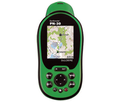
Never Get Lost Again When was the last time you wasted valuable travel time because you took a wrong turn in an unfamiliar location? Now there's an affordable and reliable solution - the new Earthmate GPS receiver. The small and flexible Earthmate GPS receiver is a high-performance, easy-to-use link to the satellite navigation technology of the Global Positioning System (GPS). Accessing these satellites is available for no additional charge. Earthmate, connected to a USB laptop PC, shows your real-time position on detailed Street Atlas USA maps anywhere in the U.S. (software included). You will always know where you are and where you need to go.Minimize
Manufacturer:DeLorme Product MPN MPN | AE-006761-201 | Key Features GPS Type | Automobile | Form Factor | Wireless Receiver Module | Map capabilities | Internal | Enhanced accuracy | WAAS enabled | Receiver Type | 12 Channels | Technical Features Included Software/Maps | USA Maps | Other Features PC Interface | USB | GPS System Accuisition Time - Cold | 45 sec | Max. Horizontal accuracy | | Enhanced position accuracy | PDA Features | Compatible PDA OS | Windows XP, Windows 2000, Windows ME, Windows 98SE | Compatible Devices | Notebook | Dimensions Width | 1.88 in. | Height | 2.09 in. |
Tags:delorme, earthmate,
| Acr Electronics TerraFix 406$234.00 to $487.00
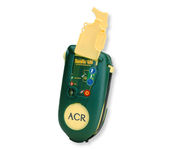
Accidents happen every day in the outdoors, whether you fall out of a tree stand, break a leg during a hike, or roll over on an ATV. In the outdoors, an every day accident instantly can become a life threatening situation, and rescues may take days or weeks if you’re not prepared.
Manufacturer:Acr Electronics Product MPN MPN | 210218942 | Key Features GPS Type | Automobile | Form Factor | Wireless Receiver Module | Dimensions Weight | 0.83 lb. | Miscellaneous UPC | 791659001806 |
Tags:acr, electronics, terrafix, 406,
| Garmin Rino 530$405.00 to $499.00

No matter where your outdoor activities take you, the Rino® 530 keeps you on track and in touch. Similar to the 520, this rugged, two-way radio with GPS packs a bold color display, 14-mile communication range, and turn-by-turn directions - giving you peace of mind in the great outdoors. Taking it a step further, the Rino 530 adds an electronic compass, barometric altimeter, and NOAA weather receiver, making it a favorite with hikers and climbers.Minimize
Manufacturer:Garmin Product MPN MPN | 010-00392-21 | Key Features GPS Type | Handheld (Outdoor) | Form Factor | Handheld | Map capabilities | Internal, Download maps | Enhanced accuracy | WAAS enabled | Receiver Type | 12 Channels | Screen Size | 2.1 in. | Display Display Size | 1.3 in. x 1.7 in. | Display Type | 256 Color LCD TFT Display | Technical Features Special Features | Compass, Built-In Barometer, Calender, Built-In Altimeter, Two-way Radio | Trip calculator | Current speed, Route Recalculation, Trip Timers, Elevation Computer, Time of sunrise/sunset | Included Software/Maps | North America Maps, South America Maps | Grids | Lat/Lon, MGRS, UTM, Loran TD position format, Maidenhead | Other Features PC Interface | USB, Serial RS-232 | Built in memory | 56 MB | Environmental Protection | IPX7 Waterproof Standard | Antenna | Quadrifilar Helix | GPS System Accuisition Time - Cold | 45 sec | Accuisition Time - Initial Time | 15 sec | Update rate | 1 per second, continuous | Max. Horizontal accuracy | | Enhanced position accuracy | | Differential standards | DGPS Ready | Number of routes | 50 | Waypoints | 500 | Battery Battery Type and Quantity | Proprietary Lithium | Battery Life | 16 Hours | Warranty Warranty | 1 Year | Dimensions Width | 2.3 in. | Depth | 1.8 in. | Height | 7.5 in. | Weight | 0.64 lb. | Miscellaneous Family Line | Garmin Rino | UPC | 753759049089 |
Tags:garmin, rino, 530,
|
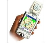
Pharos, the leader in advanced, affordable navigation solutions for handheld computing, has created the ultimate navigation tool for Windows Mobile-based Pocket PCs and mobile devices. Use Pharos Pocket GPS Navigator with CompactFlash to navigate door-to-door or point-to-point. Use it for hiking, walking tours or other outdoor activities. With audio voice prompts to guide you to your destination, the Pocket GPS Navigator is great for your car, too. In fact, the Pharos GPS Navigator performs just like more expensive, factory-installed, in-vehicle navigation systems, at a fraction of the cost yet, its easy to load into your Pocket PC and simple to use.Minimize
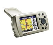
The Garmin® Quest 2 in-car GPS unit comes pre-loaded with City Select® with NT data providing mapping detail throughout the United States, Canada and Puerto Rico (including rural areas). Since there's no need to download, the Quest 2 comes to you ready to go. Its built-in database features nearly 6 million points of interest, including hotels, restaurants, gas stations, ATM's, and attractions.Minimize
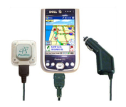
Compatible with most Pocket PCs with a CompactFlash slot, the Pharos Pocket GPS Navigator with CompactFlash inlcludes Pharos' iGPS-360 convertible receiver with a CompactFlash adaptor.Use it directly connected to the CompactFlash Adaptor, or for added flexibilty use the CF extension cable for placement and reception.Threre is no need for an external antenna!With Ostia, Pharos' award-winning navigation software installed on your Pocket PC, you can drive or walk through any city in the US, and locate your current position or quickly find a destination or point of interest. Routes can be calculated and viewed. The automated voice prompts will instruct you when and where to turn. If by chance you go "off-route," the automated voice will give an off-route warning and the system will automatically reroute you to your destination from your current position. Minimize
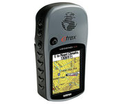
The eTrex Legend Cx is loaded with the same popular features found in the eTrex Legend C, including sunlight-readable color and advanced GPS routing capabilities — all in a waterproof design. In addition, it comes with a blank 32 MB microSD card for storage of optional map detail. Download maps directly to the card or purchase microSD cards preloaded with MapSource® Topo and inland lake maps, BlueChart® marine cartography, and City Navigator™ street maps.Minimize