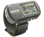
Garmin GPSMAP 76CSx$277.00 to $500.00

Safely find your way through the great outdoors with the Garmin GPSMAP 76CSx. Sporting a highly sensitive GPS receiver, the GPSMAP 76CSx can quickly and accurately chart a course through the wilderness without being impeded by dense tree cover or deep canyons. An included barometric altimeter and electronic compass give you an unprecedented level of accuracy over pinpointing your location and with the bright, color TFT display you can easily distinguish details on the screen, even while viewing in direct sunlight. The GPSMAP 76CSx is also fully waterproof and even floats in water.Minimize
Manufacturer:Garmin Product MPN MPN | 010-00469-01 | Key Features GPS Type | Marine | Form Factor | Handheld | Map capabilities | Internal, Download maps | Enhanced accuracy | WAAS enabled | Input Method | Keypad | Screen Size | 2.7 in. | Display Display Size | 1.5 in. x 2.2 in. | Display Type | 256 Color LCD TFT Display | Resolutions | 160 X 240 | Technical Features Special Features | Waypoint Icons, Compass, Built-In Altimeter | Audible Features | Proximity Alarm, Anchor Alarm, Arrival Alarm, Off-Course Alarm, Clock Alarm, Shallow/Deep Alarm | Trip calculator | Moving average, Maximum speed, Odometer, Elevation Computer, Time of sunrise/sunset, Track Log, Points-of-Interest (POI) | Included Software/Maps | North America Maps, South America Maps | Grids | Lat/Lon, MGRS, User Grid, UTM, Loran TD position format, Maidenhead | Other Features PC Interface | USB, NMEA-0183 | Environmental Protection | IPX7 Waterproof Standard, High Impact Plastic Alloy Body | Expansion Slot Type | SD (Secure Digital) Card Slot | Antenna | Built-in, Quadrifilar Helix | GPS System Accuisition Time - Cold | 38 sec | Accuisition Time - Initial Time | 1 sec | Update rate | 1 per second, continuous | Max. Horizontal accuracy | | Differential standards | DGPS Ready | Number of routes | 50 | Waypoints | 1000 | Battery Battery Type and Quantity | 2 x AA Batteries | Battery Life | 18 Hours | Warranty Warranty | 1 Year | Dimensions Width | 2.7 in. | Depth | 1.4 in. | Height | 6.2 in. | Weight | 0.48 lb. | Miscellaneous Family Line | Garmin GPSMAP | UPC | 753759051648 |
Tags:garmin, gpsmap, 76csx,
| TomTom Navigator 3$150.00 to $160.00

Get moving with TomTom Navigator 3. The flexible and personal car navigation system works on your Pocket PC. TomTom Navigator 3 guides you effortlessly from door to door via the best route. Clear 3D colour maps and spoken instructions take the stress out of driving. Plan the best route when you have multiple stops: pick up colleagues on the way to a meeting or friends on the way to a restaurant. Route around areas you would like to avoid due to traffic jams or road works. The Major Roads of Europe feature makes planning and navigating international trips easier than ever. Plan the best route from Munich to Lyon, and TomTom will guide you there.Minimize
Manufacturer:TomTom Product MPN MPN | 1C90.080 | Key Features GPS Type | Handheld (Outdoor) | Form Factor | Handheld, Plug-in | Map capabilities | Internal, Download maps | Technical Features Audible Features | Voice Navigation Instructions | Trip calculator | Route Recalculation, Points-of-Interest (POI) | Included Software/Maps | Europe Maps | GPS System Accuisition Time - Cold | 51 sec | Accuisition Time - Initial Time | 37 sec | Accuisition Time - Hot | 3 sec | Waypoints | 1000 | PDA Features Compatible PDA OS | Pocket PC | Compatible Devices | Pocket PC Based PDA | Miscellaneous Family Line | Tomtom Navigator | UPC | 636926005876 |
Tags:tomtom, navigator, 3,
| Pharos Science iGPS-360$50.00 to $134.00

Compatible with most Pocket PCs with a CompactFlash slot, the Pharos Pocket GPS Navigator with CompactFlash inlcludes Pharos' iGPS-360 convertible receiver with a CompactFlash adaptor.Use it directly connected to the CompactFlash Adaptor, or for added flexibilty use the CF extension cable for placement and reception.Threre is no need for an external antenna!With Ostia, Pharos' award-winning navigation software installed on your Pocket PC, you can drive or walk through any city in the US, and locate your current position or quickly find a destination or point of interest. Routes can be calculated and viewed. The automated voice prompts will instruct you when and where to turn. If by chance you go "off-route," the automated voice will give an off-route warning and the system will automatically reroute you to your destination from your current position. Minimize
Manufacturer:Pharos Science Product MPN MPN | REC20 | Key Features GPS Type | Handheld (Outdoor) | Form Factor | Plug-in | Enhanced accuracy | WAAS enabled, EGNOS enabled | Receiver Type | 12 Channels | Other Features PC Interface | USB, Serial RS-232, Bluetooth | Antenna | Built-in | GPS System Accuisition Time - Cold | 60 sec | Accuisition Time - Initial Time | 40 sec | Accuisition Time - Hot | 5 sec | Max. Horizontal accuracy | Dimensions | Width | 1.93 in. | Depth | 0.63 in. | Height | 2.17 in. | Weight | 0.09 lb. | Miscellaneous UPC | 818948001382 |
Tags:pharos, science, igps-360,
|


