Products reviews

Garmin eTrex Summit

$165.00 to $299.00


The eTrex Summit comes on the heels of the extremely popular eTrex, which was designed for both marine and recreation use. This new all-in-one navigation device for the outdoor enthusiast is the first combination GPS, altimeter, and electronic compass. The electronic compass provides bearing information when you're standing still and the altimeter determines precise altitude, so you can tell how high you've climbed and your rate of ascent. Like its predecessor, the eTrex Summit boasts a powerful 12 parallel channel GPS receiver and comes packaged in a small, sleek case with operating buttons located on either side of the unit. The case is completely waterproof to withstand immersion in one meter of water for up to 30 minutes.Minimize

Manufacturer:Garmin Product MPNKey FeaturesDisplayTechnical FeaturesOther FeaturesGPS SystemBatteryWarrantyDimensionsMiscellaneous
MPNeTrexSummit
GPS Type   Marine
Form FactorHandheld
Receiver Type12 Channels
Screen Size2.4 in.
Display Size1.1 in. x 2.1 in.
Display Type4 Level Grayscale LCD Display
Special Features   Waypoint Icons, Compass, Built-In Barometer, Built-In Altimeter
Trip calculator   Maximum speed, Current speed, Trip Timers, Elevation Computer, Time of sunrise/sunset, Track Log, Points-of-Interest (POI)
Grids   Lat/Lon, MGRS, UTM, Maidenhead
PC InterfaceSerial RS-232, NMEA-0183
Environmental ProtectionIPX7 Waterproof Standard
AntennaBuilt-in
Accuisition Time - Cold45 sec
Accuisition Time - Initial Time15 sec
Update rate1 per second, continuous
Max. Horizontal accuracy   Differential standardsDGPS Ready
Number of routes20
Waypoints   500
Battery Type and Quantity2 x AA Batteries
Battery Life16 Hours
Warranty1 Year
Width2 in.
Depth1.2 in.
Height4.4 in.
Weight0.33 lb.
Family LineGarmin eTrex
UPC753759072926


Tags:

garmin, etrex, summit,

Garmin Forerunner 205

$128.00 to $413.00


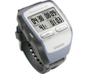
The Forerunner 205 sports a unique design that wraps the GPS antenna around part of the wrist for a better view of the sky, and its high sensitivity GPS receiver can track under trees and near tall buildings.

Manufacturer:Garmin Product MPNKey FeaturesDisplayTechnical FeaturesOther FeaturesGPS SystemBatteryWarrantyDimensionsMiscellaneous
MPN010-00466-00
GPS Type   Handheld (Outdoor)
Form FactorHandheld
Input Method   Keypad
Screen Size1.5 in.
Display Size1.3 in. x 0.8 in.
Display TypeLCD Display
Resolutions160 X 100
Special Features   Training Computer, 3D Map View
Trip calculator   Maximum speed, Current speed, Trip Timers, Elevation Computer, Time of sunrise/sunset
PC InterfaceUSB
Environmental ProtectionIPX7 Waterproof Standard
AntennaBuilt-in
Accuisition Time - Cold45 sec
Accuisition Time - Initial Time38 sec
Accuisition Time - Hot1 sec
Update rate1 per second, continuous
Max. Horizontal accuracy   Number of routes50
Waypoints   100
Battery Type and QuantityProprietary Lithium
Battery Life10 Hours
Warranty1 Year
Width2.1 in.
Depth2.7 in.
Height0.7 in.
Weight0.17 lb.
Family LineGarmin Forerunner
UPC753759051914


Tags:

garmin, forerunner, 205,

Garmin Edge 305

$175.00 to $449.00


Rugged, lightweight Edge attaches easily to the stem or handlebars of your bike with the included bike mount. Just turn it on, acquire GPS satellites and go. Edge 305 automatically measures your speed, distance, time, calories burned, altitude, climb and descent, and also records the route you have taken for review. For extra-precise climb and descent data, Edge 305 also incorporates a barometric altimeter to pinpoint changes in elevation.Minimize

Manufacturer:Garmin Product MPNKey FeaturesDisplayTechnical FeaturesOther FeaturesBatteryWarrantyDimensionsMiscellaneous
MPNGE305CAD
GPS Type   Handheld (Outdoor)
Form FactorHandheld
Screen Size1.9 in.
Display Size1.17 in. x 1.44 in.
Display Type4 Level Grayscale LCD Display
Resolutions128 x 160
Special Features   Built-In Barometer, Built-In Altimeter, Heart Rate Monitor, Training Computer
Trip calculator   Maximum speed, Elevation Computer
PC InterfaceUSB
Environmental ProtectionIPX7 Waterproof Standard
AntennaBuilt-in
Battery Type and QuantityProprietary Lithium
Battery Life12 Hours
Warranty1 Year
Width1.75 in.
Depth0.9 in.
Height3.7 in.
Weight0.19 lb.
UPC753759051716


Tags:

garmin, edge, 305,


Garmin GPSMAP 3205


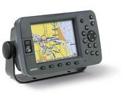
Plug into the power of the Garmin Marine network with the Garmin 3200 series. Rugged, waterproof, and easy to install, these chartplotters come preloaded with Garmin's detail-rich marine cartography utilizing BlueChart® g2 technology.


Pharos Science iGPS-360
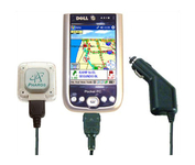

Compatible with most Pocket PCs with a CompactFlash slot, the Pharos Pocket GPS Navigator with CompactFlash inlcludes Pharos' iGPS-360 convertible receiver with a CompactFlash adaptor.Use it directly connected to the CompactFlash Adaptor, or for added flexibilty use the CF extension cable for placement and reception.Threre is no need for an external antenna!With Ostia, Pharos' award-winning navigation software installed on your Pocket PC, you can drive or walk through any city in the US, and locate your current position or quickly find a destination or point of interest. Routes can be calculated and viewed. The automated voice prompts will instruct you when and where to turn. If by chance you go "off-route," the automated voice will give an off-route warning and the system will automatically reroute you to your destination from your current position. Minimize


Garmin GPSMAP 4212


This preloaded, offshore chartplotter combines the power of networking with brilliant color and slim-line design. The GPSMAP 4212 has preloaded BlueChart® g2 maps of the U.S. coast and displays them on a whopping 12.1” XGA display with crisp, video-quality resolution. By connecting to the Garmin Marine Network, you can add sonar, radar and weather. For even more enhanced features, you can add the optional Bluechart g2 Vision card.Minimize


Garmin eTrex Legend Cx
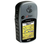

The eTrex Legend Cx is loaded with the same popular features found in the eTrex Legend C, including sunlight-readable color and advanced GPS routing capabilities — all in a waterproof design. In addition, it comes with a blank 32 MB microSD card for storage of optional map detail. Download maps directly to the card or purchase microSD cards preloaded with MapSource® Topo and inland lake maps, BlueChart® marine cartography, and City Navigator™ street maps.Minimize