Interphase Corporation Chart Master V6i$531.00 to $573.00

One of the first things a boater will notice about the Chart Master V6 series is their vertically oriented high-definition (234x320 pixel) six-inch super-bright color LCD displays. They provide clear visibility even in full sunlight, and the Chart Master V6I, with it's built-in GPS antenna is a great choice for boats with open cockpits, center consoles and flying bridges and can serve well as a back-up unitMinimize
Manufacturer:Interphase Corporation Product MPN MPN | U1CHRTV6I | Key Features GPS Type | Marine | Form Factor | Fixed | Map capabilities | Internal, Map cartridges / Data cards | Enhanced accuracy | WAAS enabled | Input Method | Keypad, Thumb Stick | Receiver Type | 12 Channels | Display Display Size | 5.7 in. | Display Type | 256 Color LCD TFT Display | Resolutions | 234 X 320 | Technical Features Marine Features | Tide Prediction, Depth Display, Chart Plotter, Sonar / Sounder, MOB (Man Over Board) | Special Features | Waypoint Icons, Compass | Audible Features | Shallow/Deep Alarm | Included Software/Maps | Marine Cartography | Grids | Lat/Lon | Other Features PC Interface | USB, NMEA-0183, NMEA-0180 | Antenna | Built-in | GPS System Accuisition Time - Cold | 45 sec | Accuisition Time - Hot | 8 sec | Update rate | 1 per second, continuous | Enhanced position accuracy | | Number of routes | 25 | Waypoints | 500 | Warranty Warranty | 5 Years | Dimensions Width | 3.38 in. | Depth | 2 in. | Height | 4.5 in. | Weight | 2 lb. | Miscellaneous UPC | 027037002692 |
Tags:interphase, corporation, chart, master, v6i,
| Garmin nuvi 200W$150.00 to $350.00
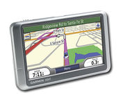
Wide and way cool, nüvi 200W shows you the way with detailed maps on a bright widescreen display and clear, voice-prompted directions. This stylish navigator and travel companion comes with preloaded maps for the lower 48 states, Hawaii and Puerto Rico or regional coverage in other areas. Like the rest of the nüvi 200-series, nüvi 200W is affordably priced and simple to use.Minimize
Manufacturer:Garmin Product MPN MPN | 010-N0656-1 | Key Features GPS Type | Automobile | Form Factor | Fixed | Map capabilities | Internal, Map cartridges / Data cards | Enhanced accuracy | WAAS enabled, EGNOS enabled | Input Method | Touch Screen | Receiver Type | 12 Channels | Screen Size | 4.4 in. | Display Display Size | 3.81 in. x 2.25 in. | Display Type | 65k Colors Display | Resolutions | 480 x 272 | Technical Features Special Features | Waypoint Icons, JPEG Image Viewer, Converter, Calculator, 3D Map View | Audible Features | Voice Navigation Instructions | Trip calculator | Shortest time, Shortest distance, Maximum speed, Odometer, Current speed, Route Recalculation, Trip Timers, Avoid toll roads, Detour Feature, Points-of-Interest (POI) | Included Software/Maps | Europe Maps, Germany Maps | Other Features PC Interface | USB | Expansion Slot Type | SD (Secure Digital) Card Slot | Antenna | Built-in | GPS System Waypoints | 500 | Battery Battery Type and Quantity | Rechargeable Li-Ion Battery | Battery Life | 5 Hours | Dimensions Width | 4.8 in. | Depth | 0.8 in. | Height | 2.9 in. | Weight | 0.38 lb. | Miscellaneous Family Line | Garmin nuvi | UPC | 753759074524 |
Tags:garmin, nuvi, 200w,
|
Wide and way cool, nüvi 200W shows you the way with detailed maps on a bright widescreen display and clear, voice-prompted directions. This stylish navigator and travel companion comes with preloaded maps for the lower 48 states, Hawaii and Puerto Rico or regional coverage in other areas. Like the rest of the nüvi 200-series, nüvi 200W is affordably priced and simple to use.Minimize
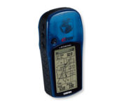
With the eTrex Legend, GARMIN has loaded a full basemap of North and South America into one small unit. The Legend is also designed to provide precise GPS positioning using correction data obtained from the Wide Area Augmentation System (WAAS). This product will provide position accuracy to less than three meters when receiving WAAS corrections.Minimize
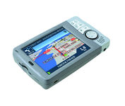
Transferable from car-to-car in seconds, the easy-to-use iCN510 can effortlessly guide drivers to their desired destination using accurate and clear turn-by-turn voice instructions and 3D-map view. Users can also now Drive Away this compact and sleek system straight from the box, with software applications and complete U.K. street-level mapping loaded on a single memory card. The iCN510 incorporates Version 3.0 of Navmans award winning SmartST software, which includes new features such as My POI customable points of interest with approach notification settings, multiple destinations for planning trips with several stops along the way, and a nearest POI search facility.Minimize
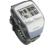
The Forerunner 205 sports a unique design that wraps the GPS antenna around part of the wrist for a better view of the sky, and its high sensitivity GPS receiver can track under trees and near tall buildings.
