Garmin Rino 120$167.00 to $628.00
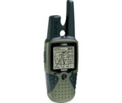
The Rino 120 is state-of-the-art GPS navigation and two-way communications combined, with enough memory to download detailed mapping for driving, hiking, hunting, fishing--or just about anything else you can dream up.
Manufacturer:Garmin Product MPN MPN | RINO120 | Key Features GPS Type | Handheld (Outdoor) | Form Factor | Handheld | Map capabilities | Internal, Download maps | Enhanced accuracy | WAAS enabled | Input Method | Thumb Stick | Receiver Type | 12 Channels | Screen Size | 2 in. | Display Display Size | 1.4 in. x 1.4 in. | Display Type | LCD Display | Resolutions | 160 X 160 | Technical Features Marine Features | Fishing Calcluator | Special Features | Waypoint Icons | Audible Features | Proximity Alarm | Trip calculator | Maximum speed, Current speed, Trip Timers, Time of sunrise/sunset, Track Log, Points-of-Interest (POI) | Included Software/Maps | Marine Cartography, North America Maps, South America Maps | Grids | Lat/Lon, MGRS, UTM, Loran TD position format, Maidenhead | Other Features PC Interface | Serial RS-232, NMEA-0183 | Environmental Protection | IPX7 Waterproof Standard | Antenna | Quadrifilar Helix | GPS System Accuisition Time - Cold | 45 sec | Accuisition Time - Initial Time | 15 sec | Update rate | 1 per second, continuous | Max. Horizontal accuracy | | Enhanced position accuracy | | Differential standards | DGPS Ready | Number of routes | 20 | Waypoints | 500 | Battery Battery Type and Quantity | 3 x AA Batteries | Battery Life | 28 Hours | Warranty Warranty | 1 Year | Dimensions Width | 2.3 in. | Depth | 1.6 in. | Height | 4.5 in. | Weight | 0.48 lb. | Miscellaneous Family Line | Garmin Rino | UPC | 689076630887 |
Tags:garmin, rino, 120,
| Garmin nuvi 200W$150.00 to $350.00
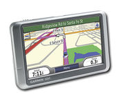
Wide and way cool, nüvi 200W shows you the way with detailed maps on a bright widescreen display and clear, voice-prompted directions. This stylish navigator and travel companion comes with preloaded maps for the lower 48 states, Hawaii and Puerto Rico or regional coverage in other areas. Like the rest of the nüvi 200-series, nüvi 200W is affordably priced and simple to use.Minimize
Manufacturer:Garmin Product MPN MPN | 010-N0656-1 | Key Features GPS Type | Automobile | Form Factor | Fixed | Map capabilities | Internal, Map cartridges / Data cards | Enhanced accuracy | WAAS enabled, EGNOS enabled | Input Method | Touch Screen | Receiver Type | 12 Channels | Screen Size | 4.4 in. | Display Display Size | 3.81 in. x 2.25 in. | Display Type | 65k Colors Display | Resolutions | 480 x 272 | Technical Features Special Features | Waypoint Icons, JPEG Image Viewer, Converter, Calculator, 3D Map View | Audible Features | Voice Navigation Instructions | Trip calculator | Shortest time, Shortest distance, Maximum speed, Odometer, Current speed, Route Recalculation, Trip Timers, Avoid toll roads, Detour Feature, Points-of-Interest (POI) | Included Software/Maps | Europe Maps, Germany Maps | Other Features PC Interface | USB | Expansion Slot Type | SD (Secure Digital) Card Slot | Antenna | Built-in | GPS System Waypoints | 500 | Battery Battery Type and Quantity | Rechargeable Li-Ion Battery | Battery Life | 5 Hours | Dimensions Width | 4.8 in. | Depth | 0.8 in. | Height | 2.9 in. | Weight | 0.38 lb. | Miscellaneous Family Line | Garmin nuvi | UPC | 753759074524 |
Tags:garmin, nuvi, 200w,
|

The GP-7000F/NT is a GPS/WAAS plotter designed for a variety of vessels desiring video plotting and echo sounding capabilities. With the GP-7000 series, you can see the highly accurate position of your boat on the chart. The GP-7000 series has four display modes: Course Plot, Nav Data, Steering, and Highway modes. The course plot mode is useful for obtaining general information about surrounding sea areas. The Nav data mode clearly shows important navigational information with large text, which is easy to see even from a distance. The steering mode and highway mode assist the operator in following a predetermined route.Minimize
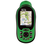
Never Get Lost Again When was the last time you wasted valuable travel time because you took a wrong turn in an unfamiliar location? Now there's an affordable and reliable solution - the new Earthmate GPS receiver. The small and flexible Earthmate GPS receiver is a high-performance, easy-to-use link to the satellite navigation technology of the Global Positioning System (GPS). Accessing these satellites is available for no additional charge. Earthmate, connected to a USB laptop PC, shows your real-time position on detailed Street Atlas USA maps anywhere in the U.S. (software included). You will always know where you are and where you need to go.Minimize
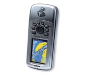
Safely find your way through the great outdoors with the Garmin GPSMAP 76CSx. Sporting a highly sensitive GPS receiver, the GPSMAP 76CSx can quickly and accurately chart a course through the wilderness without being impeded by dense tree cover or deep canyons. An included barometric altimeter and electronic compass give you an unprecedented level of accuracy over pinpointing your location and with the bright, color TFT display you can easily distinguish details on the screen, even while viewing in direct sunlight. The GPSMAP 76CSx is also fully waterproof and even floats in water.Minimize
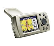
The Garmin® Quest 2 in-car GPS unit comes pre-loaded with City Select® with NT data providing mapping detail throughout the United States, Canada and Puerto Rico (including rural areas). Since there's no need to download, the Quest 2 comes to you ready to go. Its built-in database features nearly 6 million points of interest, including hotels, restaurants, gas stations, ATM's, and attractions.Minimize
