Garmin Forerunner 205$128.00 to $413.00
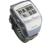
The Forerunner 205 sports a unique design that wraps the GPS antenna around part of the wrist for a better view of the sky, and its high sensitivity GPS receiver can track under trees and near tall buildings.
Manufacturer:Garmin Product MPN MPN | 010-00466-00 | Key Features GPS Type | Handheld (Outdoor) | Form Factor | Handheld | Input Method | Keypad | Screen Size | 1.5 in. | Display Display Size | 1.3 in. x 0.8 in. | Display Type | LCD Display | Resolutions | 160 X 100 | Technical Features Special Features | Training Computer, 3D Map View | Trip calculator | Maximum speed, Current speed, Trip Timers, Elevation Computer, Time of sunrise/sunset | Other Features PC Interface | USB | Environmental Protection | IPX7 Waterproof Standard | Antenna | Built-in | GPS System Accuisition Time - Cold | 45 sec | Accuisition Time - Initial Time | 38 sec | Accuisition Time - Hot | 1 sec | Update rate | 1 per second, continuous | Max. Horizontal accuracy | | Number of routes | 50 | Waypoints | 100 | Battery Battery Type and Quantity | Proprietary Lithium | Battery Life | 10 Hours | Warranty Warranty | 1 Year | Dimensions Width | 2.1 in. | Depth | 2.7 in. | Height | 0.7 in. | Weight | 0.17 lb. | Miscellaneous Family Line | Garmin Forerunner | UPC | 753759051914 |
Tags:garmin, forerunner, 205,
| Lowrance iFINDER Hunt C$445.00 to $590.00

The handheld mapping GPS designed by hunters for hunters lets you follow the big game in color with 16-channel GPS precision. The iFINDER® Hunt C with color display offers everything you'd expect in a versatile, precision mapping GPS unit made for the field, including hunting-specific icons, unique "Scout Mode", electronic compass, barometric altimeter, built-in microphone, and more.Minimize
Manufacturer:Lowrance Product MPN MPN | 112-73 | Key Features GPS Type | Handheld (Outdoor) | Form Factor | Handheld | Map capabilities | Internal, Map cartridges / Data cards | Enhanced accuracy | WAAS enabled, EGNOS enabled | Input Method | Keypad | Receiver Type | 16 Channels | Display Display Size | 2.62 in. | Display Type | 256 Color LCD TFT Display | Resolutions | 240 X 160 | Technical Features Marine Features | MOB (Man Over Board) | Special Features | Waypoint Icons, Compass, Built-In Barometer, Built-In Altimeter, MP3 Player, Voice Recorder | Included Software/Maps | USA Maps, Hawaii | Grids | Irish, WGS 84 | Other Features PC Interface | NMEA-0183 | Environmental Protection | IPX7 Waterproof Standard | Expansion Slot Type | SD (Secure Digital) Card Slot, MultiMediaCard (MMC) slot | Antenna | External Antenna Hookup | GPS System Update rate | 1 per second, continuous | Enhanced position accuracy | | Number of routes | 100 | Waypoints | 2000 | Battery Battery Type and Quantity | 2 x AA Batteries | Battery Life | 16 Hours | Warranty Warranty | 1 Year | Dimensions Width | 2.5 in. | Depth | 1.2 in. | Height | 5.6 in. | Weight | 0.54 lb. | Miscellaneous Family Line | Lowrance iFINDER | UPC | 042194524757 |
Tags:lowrance, ifinder, hunt, c,
|

The Dual XNA3550 features an easy to use touch screen graphic interface with MP3 playback capability. Turn-by-turn instructions with voice guidance. Visual left/right LED indicators. 3D Map view. Level selectable map view. Start route guidance search by:- Address/intersection- Points of interest- Address book- Recent destination. GPS status indicator.Minimize

The eTrex Summit comes on the heels of the extremely popular eTrex, which was designed for both marine and recreation use. This new all-in-one navigation device for the outdoor enthusiast is the first combination GPS, altimeter, and electronic compass. The electronic compass provides bearing information when you're standing still and the altimeter determines precise altitude, so you can tell how high you've climbed and your rate of ascent. Like its predecessor, the eTrex Summit boasts a powerful 12 parallel channel GPS receiver and comes packaged in a small, sleek case with operating buttons located on either side of the unit. The case is completely waterproof to withstand immersion in one meter of water for up to 30 minutes.Minimize

The GPS 72 is a low-cost solution for land or marine navigation designed to provide precise GPS positioning using correction data obtained from the Wide Area Augmentation System (WAAS). The GPS 72 can provide position accuracy to less than three meters when receiving WAAS corrections. This rugged, waterproof, unsinkable GPS receiver offers a large, 4-level grayscale screen. It's designed as the next generation in basic, entry-level GARMIN GPS.Minimize
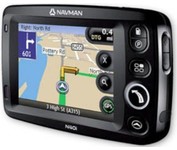
The N40i includes an integrated digital camera for taking NavPix to create an unmistakeable reminder of your chosen destination. So you can find your way there - no matter how far away it is – whenever you want.
